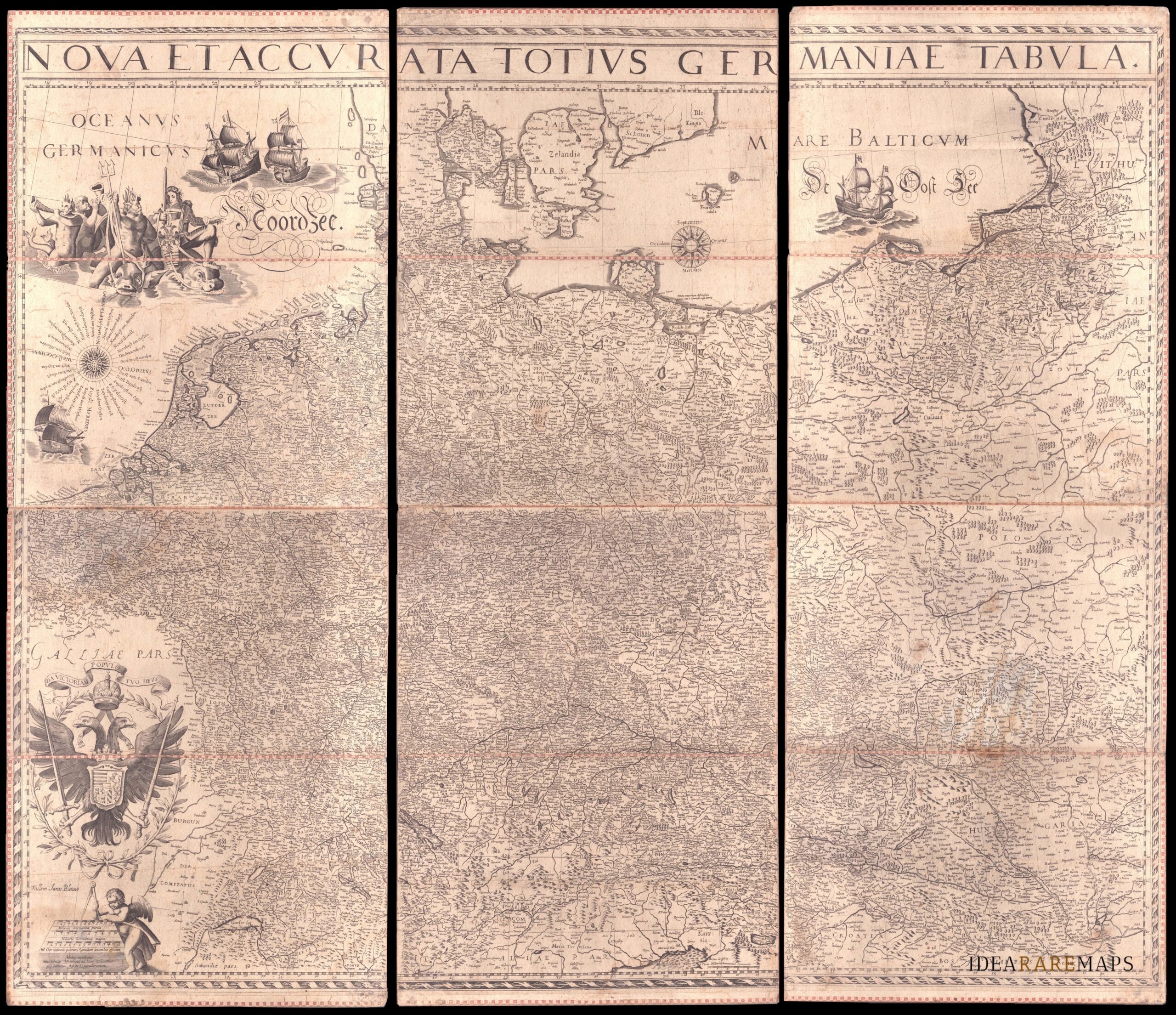
Eccezionale e rarissima grande carta murale del Sacro Romano Impero che mostra in elevato dettaglio Germania, Paesi Bassi, Austria, Boemia, Moravia, Polonia e i Paesi del Baltico. Pubblicata da Willem Janszoon Blaeu su sei fogli anticamente riportati su pannelli di carta spessa che, permettendone la piegatura su se stessa, avevano lo scopo di favorirne la consultazione e un facile trasporto. Oggi tutte le mappe murali di questo tipo sono una grande rarità: essendo molto costose e tecnicamente difficili da produrre venivano stampate in quantità molto limitate e inoltre le grandi dimensioni e il modo in cui venivano esposte le rendevano particolarmente vulnerabili ai danni tanto che pochissimi esemplari sono giunti fino ai giorni nostri. Se ne conoscono solo altri tre esemplari. Schilder nel Monumenta Cartographica Neerlandica cita soli altri tre esemplari conosciuti.
Nova et Accurata Totius Germaniae Tabula
An exceptional wall map of the German Empire showing the Netherlands, Germany, Switzerland, Austria, Bohemia, Moravia, Poland and the Baltic Countries. Only three other copies are known to Schilder. Contemporary mounted on cardboard.
- Author: Willem Janszoon Blaeu
- Dimension: 108 x 125 cm
- Place of publication: Amsterdam
- Year: 1639
€ 18.000,00
Related products
-
Out of stock
A rare very detailed cartoon map of Frankfurt am Main published in Darmstadt in 1954 by Stars UY Stripes. All the historic sites, streets and famous buildings are labeled and many of them are illustrated by lovely vignettes or caricatures (see Beethoven, Goethe, Stolze, Adickes and others). The funny map drawn by Byrel W. Burgess shows also all the Frankfurt greater area with a particular attention to the American presence (schools, hospitals, posts etc.). Chicago it’s curiously drawn in top right corner.
- Author: Byrel W. Burgess
- Dimension: 59,5 x 89 cm
- Place of publication: Darmstadt
- Year: 1954
-
A beautiful colored pictorial map with inset map of Europe showing location of Nazi Germany, promoting tourism. Showing major cities, historical people and places of interest, agriculture, industry, sports, Berlin and 1936 Olympic Games. On verso map of Germany showing roads and railways, inset map of air routes, and text and tourist information. Drawn by Riemer and published in Berlin by Reichsbahnzentrale fur den Deutschen Reiseverkehr in 1941.
- Author: Riemer
- Dimension: 77 x 57 cm
- Place of publication: Berlin
- Year: 1941
-
Superb map of the German Empire showing northern Europe, from the eastern tip of England to Poland, and extends from the North Sea to Venice and the coast of Croatia published by Johan Baptiste Vrients for the 1612 edition of Ortelius’ Theatrum Orbis Terrarum, the first modern atlas of the world. This plate was acquired by Vrients in 1603 from the engraver Franz Hogenberg (see his signature in the centre of the lower-left cartouche) and incorporated…
- Author: ORTELIUS Abraham
- Year: 1612
- Dimension: 381 x 490 mm
- Place of publication: Antwerp
-
Detailed topographical map of Berlin published in 1962, very shortly after the construction of the Berlin wall which isolated the west part from the east until 1989, by the Presse- und Informationsamt des Landes.
The powerful map is interesting also because it is before the construction of the second wall beginning in June 1963, which established the so-called death strip.
At top large title and the the coat of arms of Berlin west (a black bear on a white shield) introduced in 1954.- Author: Presse- und Informationsamt des Landes Berlin (PIA)
- Dimension: 60 x 83 cm
- Place of publication: Berlin
- Year: 1962


