Umbria
Showing all 12 results
-
Out of stock
Nice and detailed map of Lazio centered on Rome from “Parallela geographica Italiae veteris et novae”, a rare work by Philip Briet published in Paris in 1649 at Sebastian Cramoisy. [cod.306/15]
- Year: 1653
- Dimension: 198 x 144 mm
- Place of publication: Paris
-
Out of stock
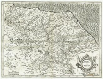
Dettagliata carta geografica della Marca di Ancona e dell’antico Ducato di Spoleto arricchita da elegante calligrafia in corsivo e da cartiglio di gusto rinascimentale con il titolo. Interessante la rappresentazione del reticolo idrografico e dell’orografia che contempla anche i rilievi minori. Tratta dall’Appendix Atlantis Majoris di G. Mercator edito ad Amsterdam nel 1606 con testo latino al verso.
- Year: 1606
- Dimension: 455 x 348 mm
- Place of publication: Amsterdam
-
Rare copper engraving from “Nova et Accurata Italiae Hoderniae Descriptio” published in Leiden by Bonaventura e A. Elsevir in 1627. [cod.290/15]
- Year: 1627
- Dimension: 175 x 243 mm
- Place of publication: Leiden
-
Rare copper engraving of Nocera Umbra from “Theatro delle citta’ d’Italia, con nova aggiunta” by Francesco Bertelli published in 1629. [cod.291/15]
- Year: 1629
- Dimension: 120 x 175 mm
- Place of publication: Padova
-
A fine miniature map from “Epitome Theatri Orbis Terraum” published in Amsterdam in 1602.The maps were based from those in P. Galle’s final edition of 1598 but were drawn and engraved with great care. They may be easily recognised as they have a wide border with latitude and longitude shown. [cod.295/15]
- Year: 1602
- Dimension: 85 x 115 mm
- Place of publication: Amsterdam
-
A fine miniature map from “Epitome Theatri Orbis Terraum” published in Amsterdam in 1602.The maps were based from those in P. Galle’s final edition of 1598 but were drawn and engraved with great care. They may be easily recognised as they have a wide border with latitude and longitude shown. [cod.296/15]
- Year: 1602
- Dimension: 85 x 115 mm
- Place of publication: Amsterdam
-
Out of stock
A very fine and detailed view of Perugia from Zeiller’s “Itinerarium Italia Nova Antiqua” published by Merian in Franckfurt in 1640. Mattheus Merian was a notable Swiss engraver, born in Basle in 1593, who subsequently studied in Zurich and then moved to Frankfurt where he met Theodore de Bry, whose daughter he married in 1617. They had numerous children together, including a daughter, Anna Maria Sibylla Merian, born in 1647. She became a pioneering […]
- Year: 1640
- Dimension: 190 x 315 mm
- Place of publication: Frankfurt
-
Out of stock
Uncommon regional map showing Emilia Romagna and Massa Carrara in Tuscany finely engraved by Pietro Allodi after a drawn by Filippo Naymiller. From Atlante di geografia universale: cronologico, storico, statistico e letterario. Milan, 1860 at Tipografia Pagnoni. Includes a second sheet of text providing really interesting geographical and statistical information on the areas shown.
- Year: 1860
- Place of publication: Milan
- Dimension: 43 x 33 cm
-
Interesting regional map of Orvieto from the Atlas Major published in Amsterdam in 1664. The famous Blaeu’s firm was founded in 1596 by Willem Janzoon Blaeu (1571-1638) then continued by his two sons Cornelius (1616-1648) and Johannis (1596-1673). Their greatest cartographic achievement was the publication of the magnificent Atlas Major with 600 maps all finely engraved and embellished by elaborate cartouches, heraldic detail and especially by splendid calligraphy. The Atlas Major represents one
- Year: 1664
- Dimension: 380 x 492 mm
- Place of publication: Amsterdam
-
Fine map of Orvieto from the french edition of Atlas major published in Amsterdam in 1667. The famous Blaeu’s firm was founded in 1596 by Willem Janzoon Blaeu (1571-1638) then continued by his two sons Cornelius (1616-1648) and Johannis (1596-1673). Their greatest cartographic achievement was the publication of the magnificent Atlas Major with 600 maps all finely engraved and embellished by elaborate […]
- Year: 1667
- Dimension: 492 x 380 mm
- Place of publication: Amsterdam
-
Nice and detailed map from “Parallela geographica Italiae veteris et novae”, a very rare work by Philip Briet published in Paris in 1649 at Sebastian Cramoisy. [cod.272/15]
- Year: 1649
- Dimension: 160 x 190 mm
- Place of publication: Paris
-
Panorama of the town from “The Ecclesiastical Architecture in Italy..” by Henry Knight. [cod.1085/15]
- Year: 1842
- Dimension: 306 x 429 mm
- Place of publication: London


