1639
Showing all 4 results
-
![]()
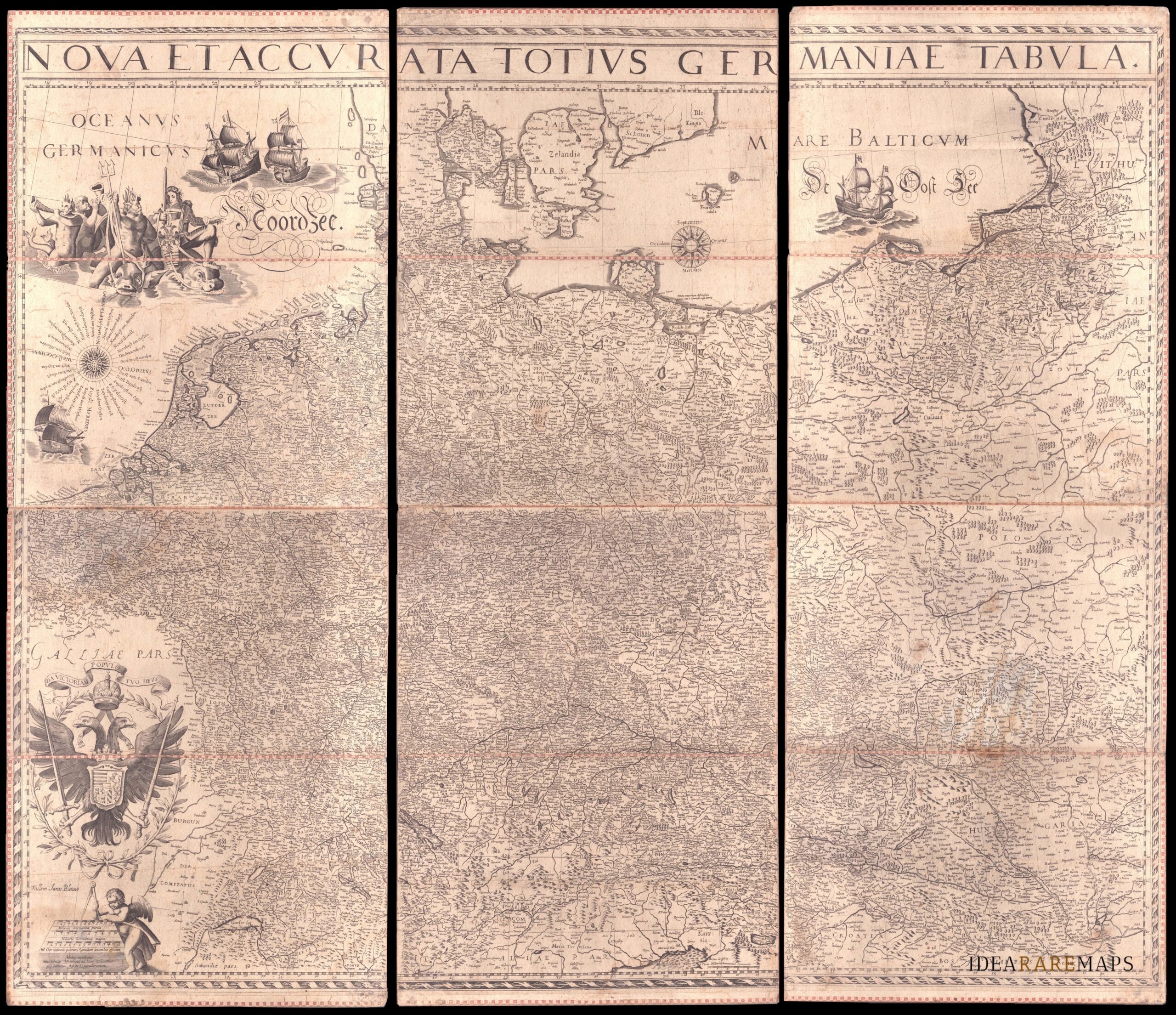
An exceptional wall map of the German Empire showing the Netherlands, Germany, Switzerland, Austria, Bohemia, Moravia, Poland and the Baltic Countries. Only three other copies are known to Schilder. Contemporary mounted on cardboard.
- Dimension: 108 x 125 cm
- Place of publication: Amsterdam
- Year: 1639
-
![]() Out of stock
Out of stockMap from the “Atlas Novus” published by Hondius and Jansson in 1639.
- Year: 1639
- Dimension: 375 x 484 mm
- Place of publication: Amsterdam
-
![]()
Map from the “Atlas Novus” published by Hondius and Jansson in 1639.
- Year: 1639
- Dimension: 384 x 490 mm
- Place of publication: Amsterdam
-
![]()
Fine map of Verona from the Hondius’ Atlas Novus published in 1639.
- Year: 1639
- Dimension: 380 x 486 mm
- Place of publication: Amsterdam