Superb map of the German Empire showing northern Europe, from the eastern tip of England to Poland, and extends from the North Sea to Venice and the coast of Croatia published by Johan Baptiste Vrients for the 1612 edition of Ortelius’ Theatrum Orbis Terrarum, the first modern atlas of the world. This plate was acquired by Vrients in 1603 from the engraver Franz Hogenberg (see his signature in the centre of the lower-left cartouche) and incorporated into later editions of Ortelius’ Theatrum Orbis Terrarum. The first Hogenberg edition, printed separately and in few copies, differs for the addition by Vrients of the city of Rouen in France (designed in the graduated border near the left cherub) which is not present in the prototype by Hogenberg.

Related products
-
![]()
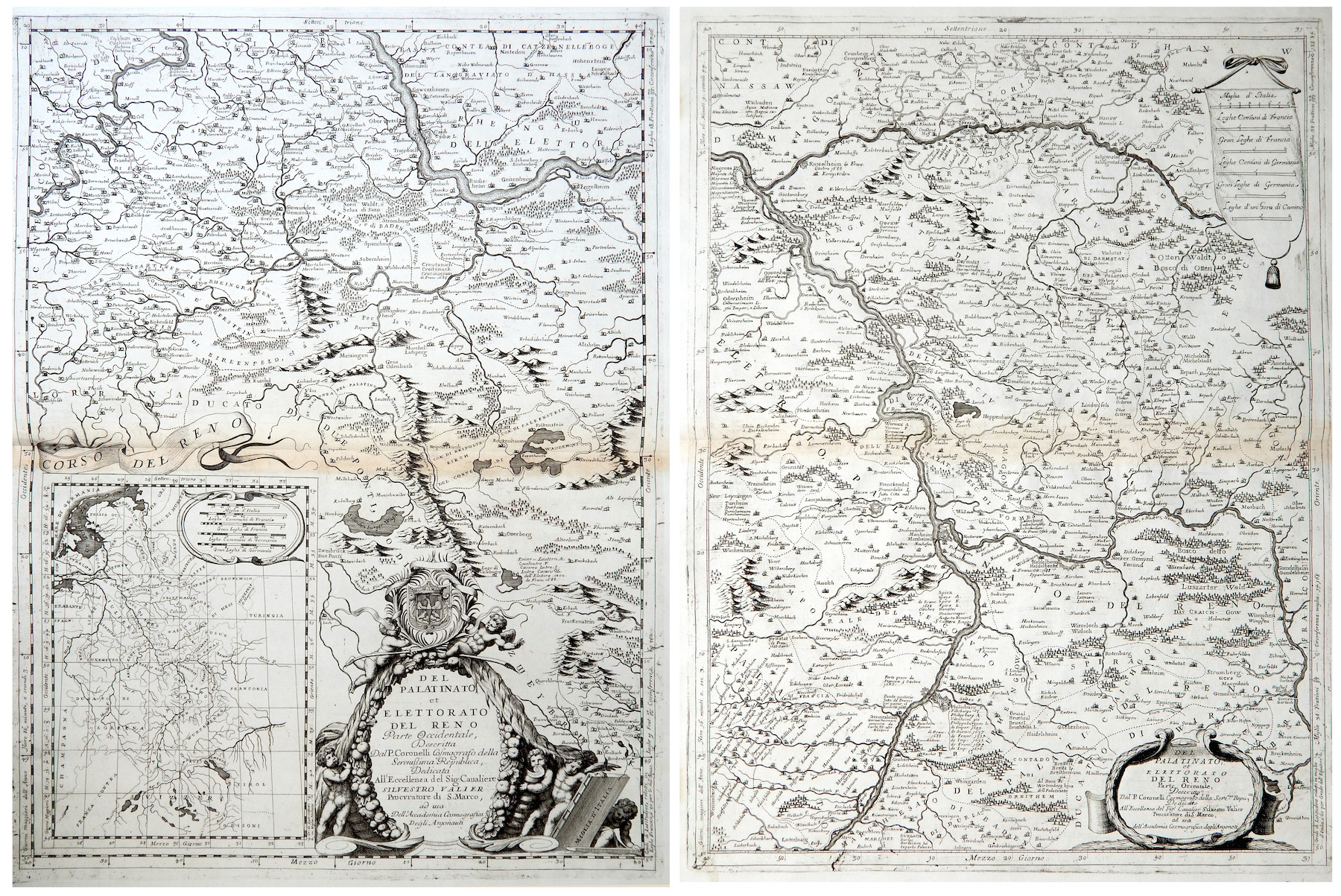
Del Palatinato et Elettorato del Reno parte Occidentale… / Del Palatinato et Elettorato del Reno parte Orientale
More Info € 600,00Very detailed and decorative map in two sheets of Rhine Valley from Coronelli’s Corso Geografico Universale published in Venice in 1690. Inset map of the entire River. Vincenzo Maria Coronelli is widely recognised as one of Italy?s most famous and greatest cartographers. He received an ecclesiastical education at the convent of the Minor Conventuals and also studied theology in Rome. However, his interests in geography and cartography were awoken early in his ecclesiastical career and never supp
- Year: 1690
- Dimension: 605 x 450 mm each
- Place of publication: Venice
-
![]() Out of stock
Out of stockA rare very detailed cartoon map of Frankfurt am Main published in Darmstadt in 1954 by Stars UY Stripes. All the historic sites, streets and famous buildings are labeled and many of them are illustrated by lovely vignettes or caricatures (see Beethoven, Goethe, Stolze, Adickes and others). The funny map drawn by Byrel W. Burgess shows also all the Frankfurt greater area with a particular attention to the American presence (schools, hospitals, posts etc.). Chicago it’s curiously drawn in top right corner.
- Dimension: 59,5 x 89 cm
- Place of publication: Darmstadt
- Year: 1954
-
![]()
A nice example of Gerard De Jode highly detailed map of Saxony centered on Mansfeld. From the rare Speculum Orbis Terrae published in Amsterdam in 1593 by Cornelis De Jode.
- Year: 1593
- Dimension: 334 x 250 mm
- Place of publication: Antwerp
-
![]() Out of stock
Out of stockDetailed topographical map of Berlin published in 1962, very shortly after the construction of the Berlin wall which isolated the west part from the east until 1989, by the Presse- und Informationsamt des Landes.
The powerful map is interesting also because it is before the construction of the second wall beginning in June 1963, which established the so-called death strip.
At top large title and the the coat of arms of Berlin west (a black bear on a white shield) introduced in 1954.- Dimension: 60 x 83 cm
- Place of publication: Berlin
- Year: 1962