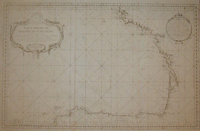
Very handsome chart of the Bay of Biscay with the north coast of Spain from Cap Finisterre, and west coast of France north to Brest. Locates Bayone, Bordeaux, Nantes, etc. with information on soundings and anchorages. From Hydrographie Francaise.
Golphe de Gascogna
Very handsome chart of the Bay of Biscay with the north coast of Spain from Cap Finisterre, and west coast of France north to Brest. Locates Bayone, Bordeaux, Nantes, etc. with information on soundings and anchorages. From Hydrographie Francaise.
- Author: BELLIN Jacques Nicholas
- Year: 1797
- Dimension: 855 x 543 mm
- Place of publication: London
€ 350,00
Related products
-
Color pictorial map of Auvergne covered with vignettes drawings of people and products of the province with explanation, representing region’s historical figures and events, resources, sights, churches, important buildings, people, activities, crops, etc. Includes decorative title cartouche and compass rose. Relief shown pictorially. Published by Ode Paris in 1951 from a drawn by Jaques Liozu.
- Author: Jacques Liozu
- Dimension: 490 x 340 mm
- Place of publication: Paris
- Year: 1951
-
Color pictorial map of department of Nord, France (which is part of the current Nord-Pas-de-Calais region) covered with vignettes drawings of people and products of the province with explanation, representing region’s historical figures and events, resources, sights, churches, important buildings, people, activities, crops, etc. Includes decorative title cartouche and compass rose. Relief shown pictorially. Published by Ode Paris in 1951 from a drawn by Jaques Liozu.
- Author: Jacques Liozu
- Dimension: 490 x 320 mm
- Place of publication: Paris
- Year: 1951
-
Copper engraved map of the island with north oriented to the left. Fully engraved with detail of rivers, mountains, cities and towns. The famous Blaeu’s firm was founded in 1596 by Willem Janzoon Blaeu (1571-1638) then continued by his two sons Cornelius (1616-1648) and Johannis (1596-1673). Their greatest cartographic achievement was the publication of the magnificent Atlas Major with 600 maps all finely engraved and embellished by elaborate cartouches, heraldic detail and especially by splendi
- Author: BLAEU Johannis
- Year: 1664
- Dimension: 180 x 240 mm
- Place of publication: Amsterdam
-
Li Governi D’ Angio, del Saumurois, della Touraine, e Poitou, D’ Aunis, e Saintonge, con quello D’ Angoumois. Di Nuova Projezione.
More Info € 150,00A map of western France above Cognac and the area around Saumur, with decorative title cartouche.Shows administrative divisions, towns, villages, forests, mountains and rivers. From Atlante Novissimo, illustrato ed accresciuto sulle osservazioni, e scoperte fatte dai più celebri e più recenti cartografi by Antonio Zatta published in Venice in 1779. In very good condition with nice and decorative original colours.
- Author: ZATTA Antonio
- Year: 1779
- Dimension: 410 x 310 mm
- Place of publication: Venice