Antwerp
Showing 1–12 of 15 results
-
![]()
Very rare first edition of the Hainaut map by Abraham Ortelius The history of this rare map is fascinating. It was based on a manuscript map by Jacques Surhon (1548), which for security reasons was not published. In 1572, Ortelius applied for privilege to publish the map, but it was never granted. The plate wasengraved anyway, and some prints (perhaps 100) made from it appeared in the 1573-1575 editions of Theatrum. That plate was then…
- Year: 1573
- Dimension: 374 x 506 mm
- Place of publication: Antwerp
-
![]()
A fine miniature map by Philippe Galle from “Epitome du Theatre” by Abraham Ortelius published in Antwerp in 1598 with french text on verso.
- Year: 1598
- Dimension: 75 x 105 mm
- Place of publication: Antwerp
-
![]()
Important and rare two maps on one sheet showing the area of Basel and the Valais by Gerard De Jode. In 1578, Gerard De Jode published his atlas entitled Speculum Orbis Terrarum but due to the strong market presence of Ortelius’ Theatrum Orbis Terrarum, sold poorly. This map comes from the second and last edition of the atlas published in 1593 by Cornelis De Jode. Cornelis de Jode (1568-1600) was the son of the mapmaker…
- Year: 1593
- Dimension: 390 x 485 mm
- Place of publication: Antwerp
-
![]() Out of stock
Out of stockA fine miniature map showing Abruzzo from “Epitome du Theatre” by Abraham Ortelius published in Antwerp in 1598 with french text on verso. The engraver was P. Galle. [cod.298/15]
- Year: 1598
- Dimension: 75 x 105 mm
- Place of publication: Antwerp
-
![]()
A fine miniature map of Artois in northern France engraved with great care by P. Galle from “Epitome du Theatre” by A. Ortelius published in Antwerp in 1598 with french text on verso.
- Year: 1598
- Dimension: 75 x 105 mm
- Place of publication: Antwerp
-
![]()
This miniature version of Ortelius’ important map of Southeast Asia shows how sketchy the available information was concerning the region. The East Indies are presented as a randomly scattered group of islands with Java and Borneo particularly misshapen. Beach pars, a presumed promontory of the great southern continent based on Marco Polo’s account, protrudes into the bottom of the map. Japan is presented in its kite-shaped form, and in the upper right corner America makes…
- Year: 1598
- Dimension: 75 x 105 mm
- Place of publication: Antwerp
-
![]()
A fine miniature map showing the course of the Elneur River, with Beauregard and Clevemont. Oriented with the North on right. From “Epitome du Theatre” by A. Ortelius published in Antwerp in 1598 with french text on verso. Engraved with great care by P. Galle. There is great attention to forest, cities, roads, rivers and villages.
- Year: 1598
- Dimension: 75 x 105 mm
- Place of publication: Antwerp
-
![]()
A nice example of Gerard De Jode highly detailed map of Saxony centered on Mansfeld. From the rare Speculum Orbis Terrae published in Amsterdam in 1593 by Cornelis De Jode.
- Year: 1593
- Dimension: 334 x 250 mm
- Place of publication: Antwerp
-
![]()
Palestinae sive Totius Terrae Promissionis Nova Descriptio Auctore Tilemanno Stella Sigenens
€ 120,00Fascinating miniature version of Ortelius’ modern map of the Holy Land finely engraved by Philippe Galle. It shows the path of the Children of Israel through the wilderness and a few major cities. French text on verso.
- Year: 1598
- Dimension: 75 x 105 mm
- Place of publication: Antwerp
-
![]()
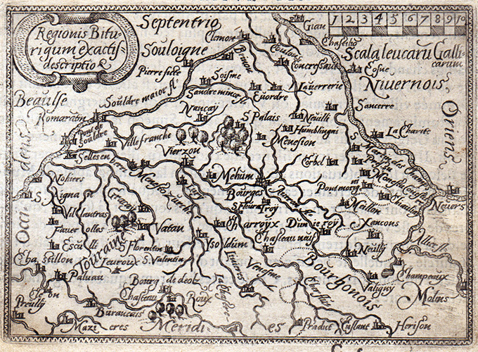
A fine miniature map showing the Loire region from Gian to Le Blang and centered on Chateau Neuf and Bourges. From “Epitome du Theatre” by A. Ortelius published in Antwerp in 1598 with french text on verso. Engraved with great care by P. Galle.
- Year: 1598
- Dimension: 75 x 105 mm
- Place of publication: Antwerp
-
![]() Out of stock
Out of stockThis is a beautiful map of southern Italy with north oriented to the left as identified by the handsome compass rose. The map is filled with detail and based on the work of Pirro Ligorio who was best known as an architect involved in the building of St. Peter’s in Rome. The title is contained in a flowing banner and a fine sailing ship further adorns the map. From the famous Theatrum Orbis Terrarum by A. Ortelius published in Antwerp in 1574.
- Year: 1574
- Dimension: 366 x 499 mm
- Place of publication: Antwerp
-
![]()
A fine miniature map of Kingdom of Neaples with the north at left from “Epitome du Theatre” published in Antwerp in 1598 with french text on verso. The engraver was P. Galle. [cod.493/15]
- Year: 1598
- Dimension: 110 x 80 mm
- Place of publication: Antwerp