


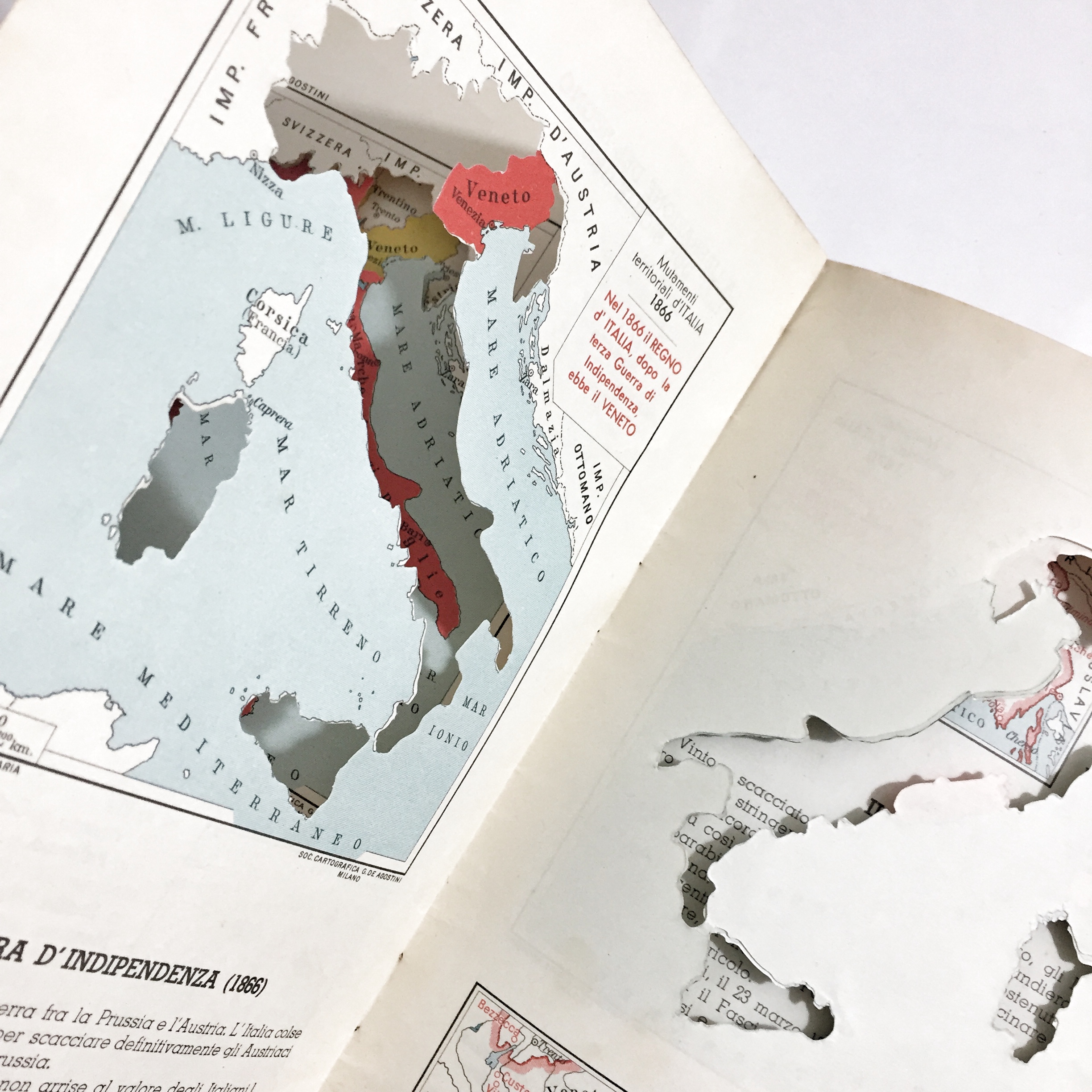
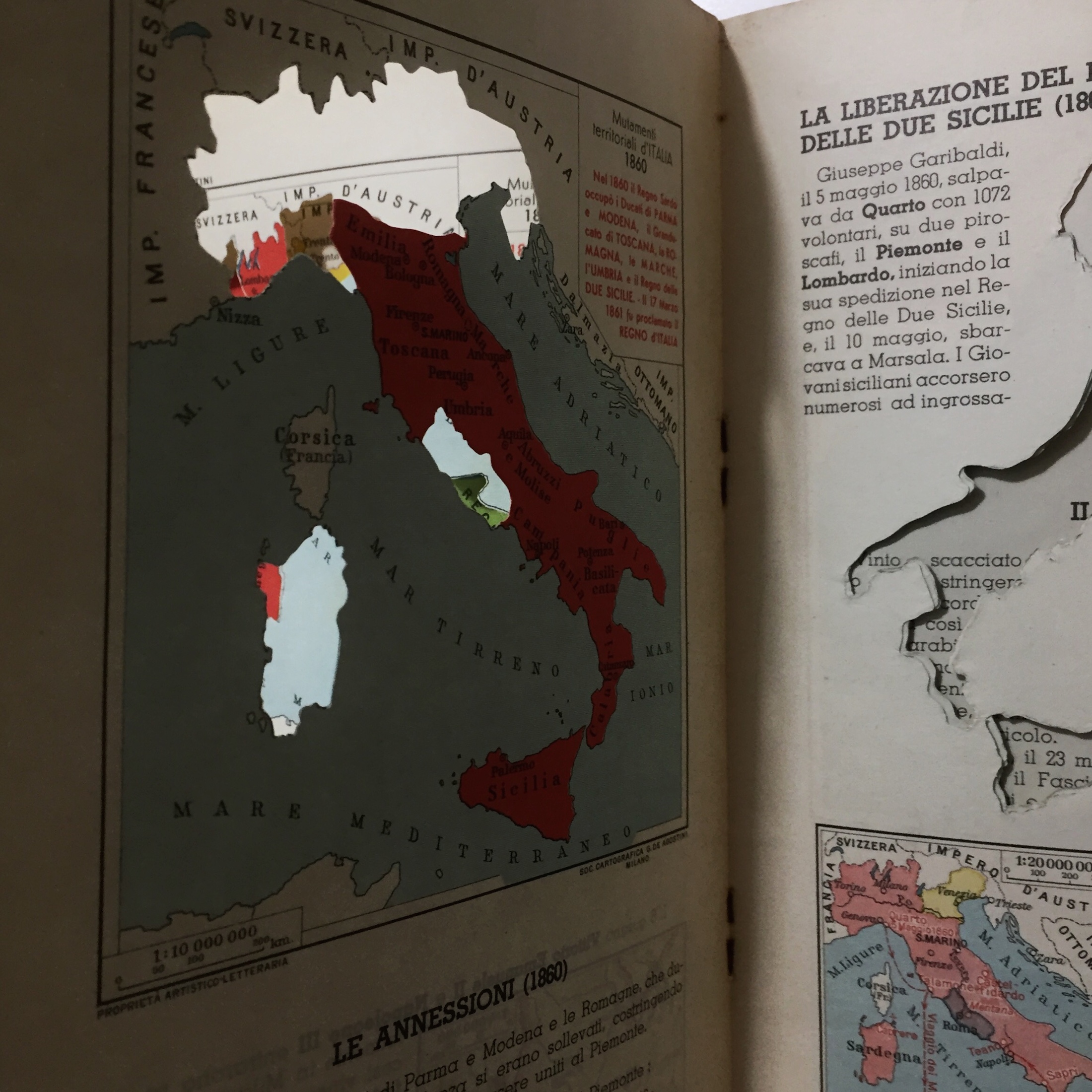
Delizioso atlantino storico dedicato ai fanciulli che mostra, con l’ausilio di curiose piccole carte geografiche traforate, la storia delle suddivisioni territoriali dal 1848 al 1929. Edizione speciale a cura della Società Unica di Torino. Edito a Milano nel 1930 da Giovanni De Agostini.
Out of stock

Atlantino Storico della Indipendenza D’Italia con Cartine Sovrapponibili
Delizioso atlantino storico dedicato ai fanciulli che mostra, con l’ausilio di curiose piccole carte geografiche traforate, la storia delle suddivisioni territoriali dal 1848 al 1929. Edizione speciale a cura della Società Unica di Torino. Edito a Milano nel 1930 da Giovanni De Agostini.
- Dimension: 23 x 15,5 cm
- Place of publication: Milan
- Year: 1930
Related products
-
![]()
Color pictorial map of Central and Eastern Europe from Greece to Poland, Baltic and Russia, with decorative title cartouche and borders, depict countries, regions, major cities, industries, agriculture and wildlife. Includes decorative compass rose oriented with the north to upper left margin. Relief shown pictorially. Published by Ode Paris in 1951 from a drawn by Jaques Liozu.
- Dimension: 410 x 560 mm
- Place of publication: Paris
- Year: 1951
-
![]()
A lovely pocket atlas of the world with text by Annibale Giglioni published in 1886 by Francesco Vallardi. With 12 colorful maps with the description of the continents, the various parts of Italy and the Globe, with indications of the races and languages spoken. See Geoffrey King Miniature Maps 1886b: “This oblong paperback is a rare item today. There is a copy located in the Biblioteca Nazionale Centrale di Firenze, where it is catalogued under…
- Dimension: 10,5 x 15,5 cm
- Place of publication: Milan
- Year: 1886
-
![]()
First edition by Longman. This is a standard reference work, incorporating a general historical background, methods of map making, practical advice on collecting old maps and a list of the major map makers. Organized country by country, it refers to over 600 cartographers active between 1450 and 1850.
- :
- Year: 1983
- Dimension: 190 x 250 mm
- :
-
![]() Out of stock
Out of stockCatalogo della mostra “L?Italia prima dell?Italia” allestita presso Centro Nazionale Studi Manzoniani a Milano. Il catalogo scheda in 159 pagine 59 carte geografiche dell’Italia da Niccol Germanico (Roma 1478), Berlinghieri, Rosselli, Silvano da Eboli, Gastaldi, Bertelli, Forlani, De Jode, Plancius, Rascioti, Blaeu, 3 edizioni di carte murali del Magini, Visscher, Speed, Janssonius, Greuter, Bassano, Bertelli, Coronelli, Petrini, Cassini, Bacler Dalbe […]
- Year: 2011
- Dimension: 240 x 230 mm


