


Interesting map of the British Isles engraved on copper by Glot. From the scarce “Atlas Portatif, contenant la Gographie Universelle Ancienne et Moderne” by Eustache Herisson published in Paris in 1809 at Desray.
Out of stock
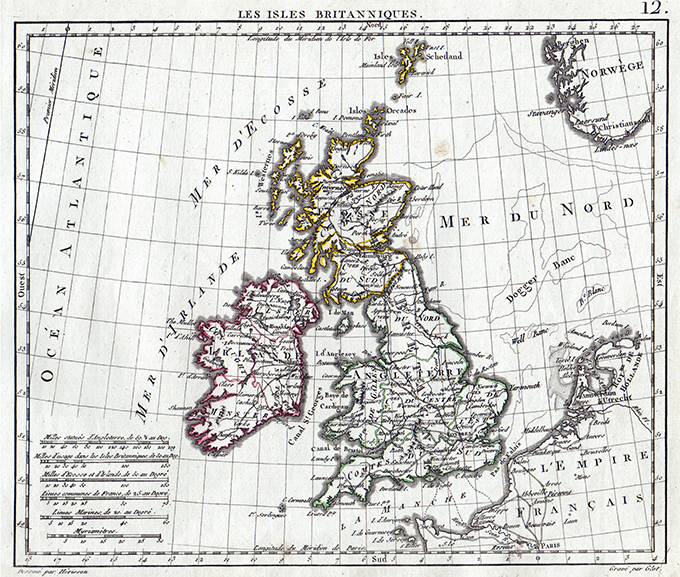
Les Isles Britanniques
Interesting map of the British Isles engraved on copper by Glot. From the scarce “Atlas Portatif, contenant la Gographie Universelle Ancienne et Moderne” by Eustache Herisson published in Paris in 1809 at Desray.
- Year: 1809
- Dimension: 212 x 180 mm
- Place of publication: Paris
Related products
-
![]()
One of only four maps of English counties by this Italian mapmaker. From ‘Atlante Novissimo’. Very good condition with nice and decorative original colours. [cod.1020/15]
- Year: 1779
- Dimension: 200 x 305 mm
- Place of publication: Venice
-
![]()
Nice and detailed map of Southern Scotland from the Mercator Hondius “Atlas Minor” published in Amsterdam in 1648 at Jannsonius with german text on verso. In 1607 Jodocus Hondius published a reduced size version of Mercator’s “Atlas”, itself suitably titled “Atlas Minor”. The maps were copied from those of the great cartographer Mercator of around 1580-90 or were reductions of Hondius’ own maps of 1606. Almost 20 years later Joannes Janssonius commissioned a new set of copperplates to be engrav
- Year: 1648
- Dimension: 195 x 135 mm
- Place of publication: Amsterdam
-
![]()
Charming map of the region centered on Oxford from the Mercator Hondius “Atlas Minor” published in Amsterdam in 1648 at Jannsonius with german text on verso. In 1607 Jodocus Hondius published a reduced size version of Mercator’s “Atlas”, itself suitably titled “Atlas Minor”. The maps were copied from those of the great cartographer Mercator of around 1580-90 or were reductions of Hondius’ own maps of 1606. Almost 20 years later Joannes Janssonius commissioned a new set of copperplates to be eng
- Year: 1648
- Dimension: 200 x 145 mm
- Place of publication: Amsterdam
-
![]()
A lovely 1914-18 Great War satirical postcard dated on verso 29 May 1915.
- Dimension: 90 x 140 mm
- Place of publication: London
- Year: 1915


