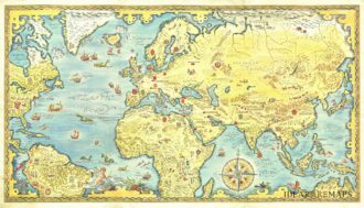
Charming illustrated world map showing the geographical origin of the animals used to make furs designed by the illustrator Paul Ternat (1897-1951) and published by A. Clerin in 1930 for the French association of fur ateliers. The decorative pictorial map is embellished by three large wind roses and galleons in the seas.
Out of stock

Related products
-
![]() Out of stock
Out of stockRare pictorial world map designed in the style of 17th century maps by the British painter and artist Gordon Davey (1912-1992) for Pakistan Airlines in 1960. The map is an interesting and curious mix between the classic geographical representations of the golden age of explorations (the wind rose, the numerous cartouches, sea monsters, galleons) and close modernity: in each country are depicted lovely little vignettes with ancient and modern reference: see for example the Roman…
- Dimension: 45,5 x 25,5 cm
- Year: 1960
-
![]() Out of stock
Out of stockOne of the most decorative eighteenth century world maps. This J.B. Homann’s double hemisphere map of the world is richly embellished with celestial models of the northern and southern hemispheres and other natural phenomena such as waterspouts, a rainbow, earthquakes, and the Mt. Etna in Sicily erupting. Wind heads occupy the starry heavens, and two cherubs hold the title banner aloft. The map includes many famous cartographic inaccuracies with an unusually elongated northwest coastline in North America, labeled Terra Esonis. It also shows an incomplete Australia, although with place names and notes of the early discoverers included. The east coast of New Zealand is shown, along with the Tracts of Tasman’s 1642 voyage and Magellan’s Voyage. The detail in Southeast Asia is very interesting for the period, as is the treatment of Japan. Interesting text panels at bottom describe the natural phenomena.
- Dimension: 48,5 x 55 cm
- Place of publication: Nuremberg
- Year: 1720
-
![]()
Globo Terrestre Delineato Sulle Ultime Osservazioni….del Cap. Cook / Globo Celeste Calcolato …. sulle Osservazioni del Sigg. Flamsteed
More Info € 9.000,00A complete set of gores (12 sheets) for a pair of globes, including calottes and printed matter for the horizon and meridian rings. The terrestrial gores show the tracks of all three of Cook’s voyages, along with his discoveries. The celestial gores, based on the observations of Flamsteed and Lacaille, are beautifully engraved and colored using the traditional, pictorial symbols for the constellations. Bound in original binding with frontispiece of Cassini’s famous work “Nuovo Atlante…
- Year: 1790
- Dimension: 320 x 490 mm
- Place of publication: Rome
-
![air france boucher]()
A very decorative world map by Lucien Boucher created for Air France published in Paris at atelier Perceval, 1939. This is one of the first maps of Air France which was founded in October 1933. Shows the beginning routes of the airline, extending west to the Americas and east to China. The route Paris-New York shown dotten because still in study (the first travel was in 1946). The whole world is filled with beautiful illustrations,…
- Dimension: 60 x 96 cm
- Place of publication: Paris
- Year: 1939