


Interesting town plan of the walled city of Novara from the rare Schauplatz des Krieges In Italien, Oder Accurate Beschreibung der Lombardey by Thomas Fritschen published in Leipzig in 1702.
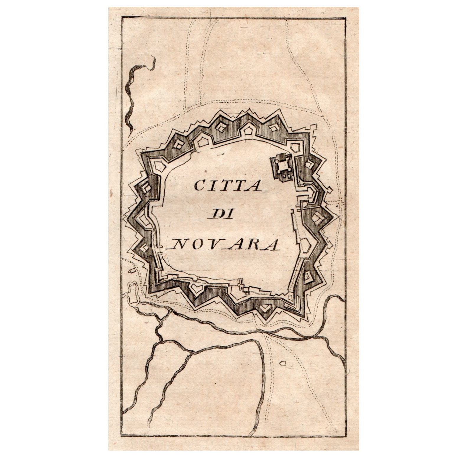
Novara
Interesting town plan of the walled city of Novara from the rare Schauplatz des Krieges In Italien, Oder Accurate Beschreibung der Lombardey by Thomas Fritschen published in Leipzig in 1702.
- Year: 1702
- Dimension: 70 x 130 mm
- Place of publication: Lipsia
€ 120,00
Related products
-
![antica pianta topografica torino]()
Rare plan of Turin embellished by 12 views showing the most interesting monuments of the city
- Dimension: 50 x 70 cm
- Place of publication: Turin
- Year: 1894
-
![]()
Rare copper engraving with original (uncommon) color. From “Piante delle citt , piazze e castelli fortificati…dello Stato di Milano” by G.B. Sesti published in Milan in 1707. Sold with a second leaf with the description of the town. [cod.337/15]
- :
- Dimension: 195 x 150 mm
- Place of publication: Milan
-
![]() Out of stock
Out of stockA nice old color example of Blaeu’s regional map of Piemonte and Monferrato from Grooten Atlas the dutch edition of the Atlas Major published in Amsterdam in 1664. The famous Blaeu’s firm was founded in 1596 by Willem Janzoon Blaeu (1571-1638) then continued by his two sons Cornelius (1616-1648) and Johannis (1596-1673). Their greatest cartographic achievement was the publication of the magnificent Atlas Major with 600 maps … [009/15]
- Year: 1664
- Dimension: 420 x 520 mm
- Place of publication: Amsterdam
-
![]()
A small topographical map of Turin from Luigi Zucoli’s famous work “Nuovissima guida dei viaggiatori in Italia”, published in Milan in 1844; a work intended for cultured travelers who journeyed across the Italian Peninsula along the routes of the nineteenth-century Grand Tour. The etching, signed “Leone Zucoli inc.” at the bottom right, depicts the capital of the Kingdom of Sardinia in the first half of the nineteenth century with geometric precision, during a period of…
- Dimension: 11 x 14 cm
- Place of publication: Milan
- Year: 1844


