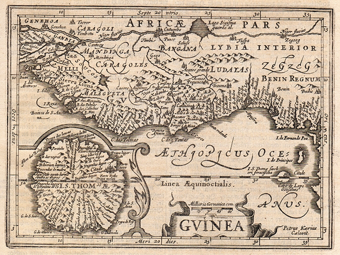
Guinea
Reduced version of Mercator?s superb map of western Africa covering from Senegal, Rio Senega, to Cape Lopez on the Gulf of Guinea just below the equator. The map reflects the Portuguese
- Author: MERCATOR Gerard - HONDIUS Henricus
- Year: 1648
- Dimension: 185 x 135 mm
- Place of publication: Amsterdam
Related products
-
Out of stock
A lovely and uncommon map of French west Africa published in Paris by the pharmaceutical laboratories Neutroses-Vichy in 1939 at Petit Jean. The Morocco, Tunisia, Algeria, Niger, Mali, Mauritania, Senegal, Guinea, and the other french regions are symbolized by small vignette.
- Dimension: 310 x 210 mm
- Place of publication: Paris
- Year: 1939
-
Out of stock
Stupenda carta geografica pittorica disegnata da Herve Baille per promuovere le rotte nell’Oceano Indiano dei nuovi transatlantici delle Messageries Maritime “Ferdinand de Lesseps”, “Jean Laborde”, La Bourdonnais” e “Pierre Loti”. La grande scena, centrata su Madagascar, Reunion, Mauritius, Comoros e il Canale del Mozambico, è dominata dai quattro transatlantici in navigazione mentre altre raffinate vignette evidenziano flora, fauna e luoghi di interesse. Frédéric Marie Joseph Hervé Baille (21 gennaio 1896 – 3 giugno 1974) è…
- Author: Frédéric Marie Joseph Hervé Baille
- Dimension: 58 x 90 cm
- Place of publication: Paris
- Year: 1950
-
Out of stock
A large pictorial map by J. Choain Audiberti of French Equatorial Africa showing several African countries including Nigeria, Chad, Cameroon, Gabon, Central African Republic and the Belgian Congo. The map is illustrated with lovely vignettes of people, farming, trees, mountains and animals like tigers, camels, horses, antelopes, ostriches, giraffes, elephants. It is completed by ships at sea, cars driving through the desert, planes flying over the map; at bottom a fine cartouche with a traditional African village scene surrounding the larger map of Africa. Published in Paris, 1950
- Author: J. Choain Audiberti
- Dimension: 120 x 80 cm
- Place of publication: Paris
- Year: 1950
-
Out of stock
Beautiful map of East Africa showing Uganda, Kenya, Tanzania and Zanzibar designed by Hameed Moghul for East African Wildlife Society. The map is richly embellished by lovely vignettes of people, birds and safari animals including a giraffe, zebra, elephants and a crocodile.
- Author: Hameed Moghul
- Dimension: 48 x 67 cm
- Place of publication: Nairobi
- Year: 1973


