Nice town view of Koblenz in Rheinland-Pfalz from Bertius’s “Commentariorum rerum germanicum libri tres” published in Amsterdam at Jannsonius in 1616.

Cobolents
Nice town view of Koblenz in Rheinland-Pfalz from Bertius’s “Commentariorum rerum germanicum libri tres” published in Amsterdam at Jannsonius in 1616.
- Year: 1616
- Dimension: 190 x 140 mm
- Place of publication: Amsterdam
€ 90,00
Related products
-
![]()
Very rare map engraved by Elias Baeck from ?Der curiose und .. Nssliche Dollmetscher..? published in Augsburg in 1748. The map has decorative cartouche and a nice original colouring. Missing in many reference.
- Year: 1748
- Dimension: 225 x 165 mm
- Place of publication: Augsburg
-
![]()
A lovely original antique miniature map centered on Bamberg showing the region of Franconia in Germany.
From the uncommon “Neu aussgeffertigter kleiner Atlas” by J. U. Muller published in Franckfurt in 1692 at Johann Philip Andrea.
The map was engraved with great care by G. Karsch e G. Bodeneher.
See G. King “Miniature antique maps” (1st edition) pag.136- Dimension: 70 x 80 mm
- Place of publication: Frankfurt
- Year: 1702
-
![]()
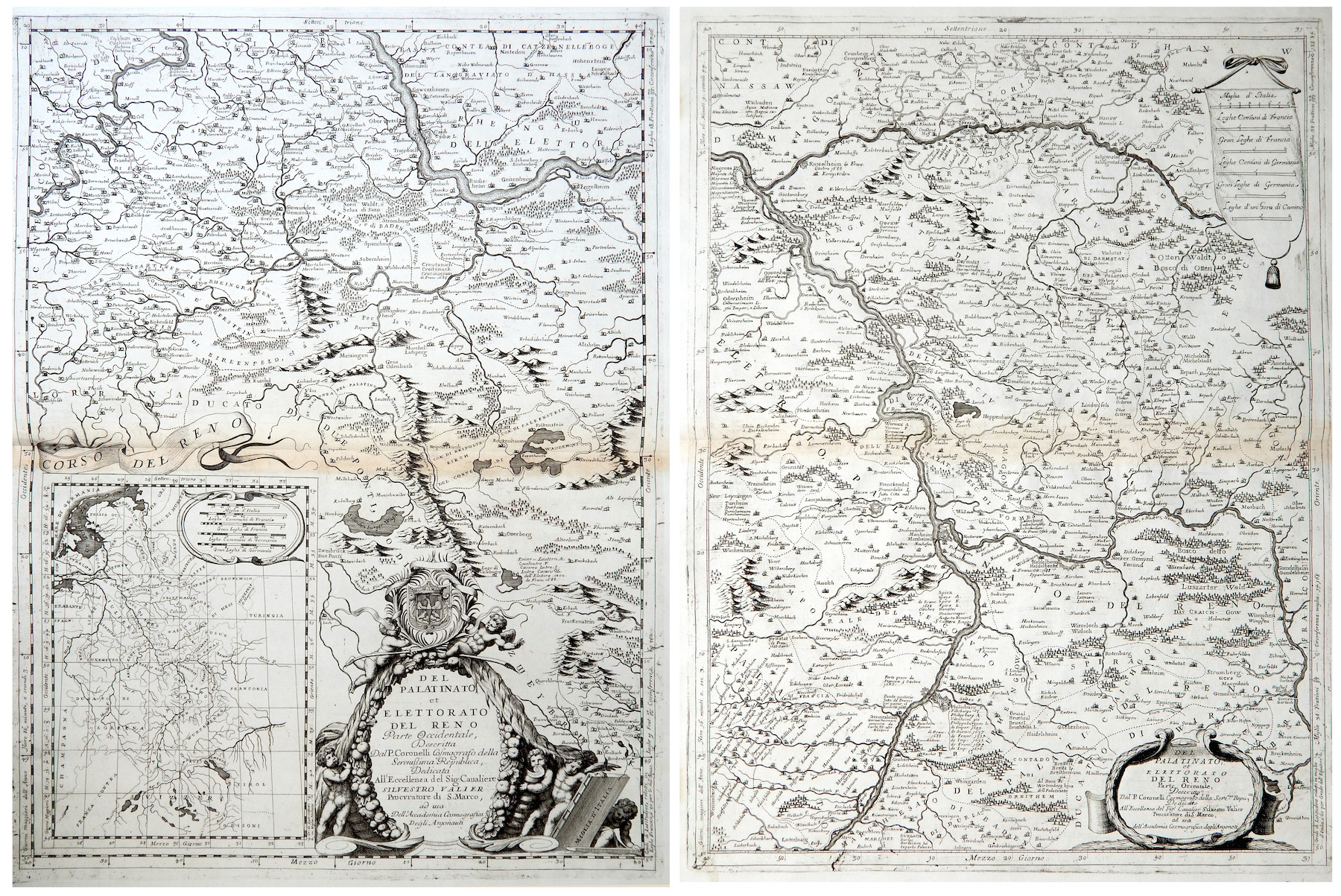
Del Palatinato et Elettorato del Reno parte Occidentale… / Del Palatinato et Elettorato del Reno parte Orientale
More Info € 600,00Very detailed and decorative map in two sheets of Rhine Valley from Coronelli’s Corso Geografico Universale published in Venice in 1690. Inset map of the entire River. Vincenzo Maria Coronelli is widely recognised as one of Italy?s most famous and greatest cartographers. He received an ecclesiastical education at the convent of the Minor Conventuals and also studied theology in Rome. However, his interests in geography and cartography were awoken early in his ecclesiastical career and never supp
- Year: 1690
- Dimension: 605 x 450 mm each
- Place of publication: Venice
-
![]()
A nice example of Gerard De Jode highly detailed map of Saxony centered on Mansfeld. From the rare Speculum Orbis Terrae published in Amsterdam in 1593 by Cornelis De Jode.
- Year: 1593
- Dimension: 334 x 250 mm
- Place of publication: Antwerp