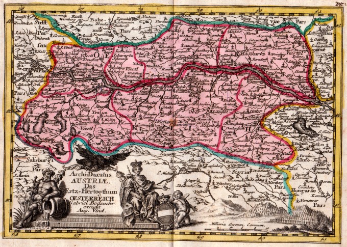
The map of Austria engraved by G. Bodhener from the rare geographical work Der curiose und .. Nssliche Dollmetscher published in Augsburg in 1748 by Machenbauer. The map has decorative cartouche and a nice original colouring.
[Austria] Archi Ducatus Austriae … Oesterreich
- Author: ERDMAN MACHENBAUER J.A.
- Year: 1748
- Dimension: 240 x 170 mm
- Place of publication: Augsburg
€ 180,00
Related products
-
A particularly attractive pictorial map of Austria and Hungary by an anonymous author published in 1930 circa. This map is covered with vignettes describing major towns and landmarks along the roads. Includes decorative cartouche with coat of arms, compass rose and inset lovely views illustrating historic architecture and interesting places.
- Author: Anon.
- Dimension: 24 x 34 cm
- Year: 1930
-
Striking example of the Mercator-Hondius map of the region centered on the Lower Danube, Bulgaria, Romania, Serbia and Macedonia. From the Mercator Hondius “Atlas Minor” published in Amsterdam in 1648 at Jannsonius. In 1607 Jodocus Hondius published a reduced size version of Mercator’s “Atlas”, itself suitably titled “Atlas Minor”. The maps were copied from those of the great cartographer Mercator of around 1580-90 or were reductions of Hondius’ own maps of 1606. Almost 20 years…
- Author: MERCATOR Gerard - HONDIUS Henricus
- Year: 1648
- Dimension: 195 x 145 mm
- Place of publication: Amsterdam
-
Delightful small map depicting present-day Poland and Lithuania. The map is fully engraved with rivers, lakes, forests and mountains and is fi lled with place names. A large, strapwork title cartouche lies in the Baltic Sea. From the Mercator Hondius “Atlas Minor” published in Amsterdam in 1648 at Jannsonius. In 1607 Jodocus Hondius published a reduced size version of Mercator’s “Atlas”, itself suitably titled “Atlas Minor”. The maps were copied from those of the great…
- Author: MERCATOR Gerard - HONDIUS Henricus
- Year: 1648
- Dimension: 195 x 146 mm
- Place of publication: Amsterdam
-
Miniature map of Pomerania embellished by rich cartouche, vessel and sea monters in the Baltic. From “Theatro del Mondo” the famous plagiarised version of Ortelius’ pocket atlas published specifically for the Italian market by Pietro Marchetti. First printed in Brescia this is the really rare Venetian edition of 1667. [cod.1213/15]
- Author: MARCHETTI Pietro
- Year: 1667
- Dimension: 75 x 105 mm
- Place of publication: Venice


