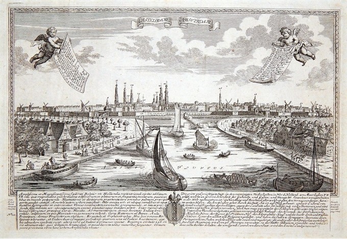
A fine panorama of Amsterdam engraved by Johann Friedrich Leopold (signed at bottom right) after F.B. Werner. At top two cherubs with a key to 40 point of interest. Below with a text about the history of the town in Latin and German. Published in Augsburg in 1730
[Netherlands] Amstelodami / Amsterdam
- Author: LEOPOLD Johann Christian
- Year: 1730
- Dimension: 300 x 200 mm
- Place of publication: Augsburg
€ 400,00
Related products
-
A very nice aquatint view by Gabriel Lory showing Mont Blanc glacier at the foot of a hill with a stream flowing from it and some bare rock in the foreground; two figures on the left of the mouth of the cave and three in the right hand foreground. Published in Paris at Osterwald in 1820.
- Author: Gabriel Lory
- Dimension: 25 x 28 cm
- Place of publication: Paris
- Year: 1820
-
A very nice aquatint view by Gabriel Lory showing the Swiss Alps with the cascade of Nant d’Arpinaz. Published in Paris at Osterwald in 1820.
- Author: Gabriel Lory
- Dimension: 25 x 28 cm
- Place of publication: Paris
- Year: 1820
-
Very detailed map showing the province of Hainaut in Belgium and the area of Cambrai in France from Coronelli’s Corso Geografico Universale published in Venice in 1690. Vincenzo Maria Coronelli is widely recognised as one of Italy’s most famous and greatest cartographers. He received an ecclesiastical education at the convent of the Minor Conventuals and also studied theology in Rome. However, his interests in geography and cartography were awoken early in his ecclesiastical career and…
- Author: CORONELLI Vincenzo Maria
- Year: 1690
- Dimension: 450 x 605 mm
- Place of publication: Venice
-
Very detailed map of Liege area from Coronelli’s Corso Geografico Universale published in Venice in 1690. Vincenzo Maria Coronelli is widely recognised as one of Italy’s most famous and greatest cartographers. He received an ecclesiastical education at the convent of the Minor Conventuals and also studied theology in Rome. However, his interests in geography and cartography were awoken early in his ecclesiastical career and never suppressed. He made very famous globes (including an impressive very…
- Author: CORONELLI Vincenzo Maria
- Year: 1690
- Dimension: 450 x 606 mm
- Place of publication: Venice


