1877
Showing all 3 results
-
A rare satirical caricature showing the British Empire as a mighty colossus standing astride the Dardanelles facing the Sea of Marmara, the Bosporus, and the Black Sea. The fine lithograph refers to an episode in the Russo-Turkish War (1877-1878) when the Ottomans defeated by the Russians were aided by the British Empire. A warning to the world against Russia’s duplicity, but also against Great Britain itself, which, although a saviour here, nevertheless expresses a sinister…
- Dimension: 40 x 56 cm
- Place of publication: Bologna
- Year: 1877
-
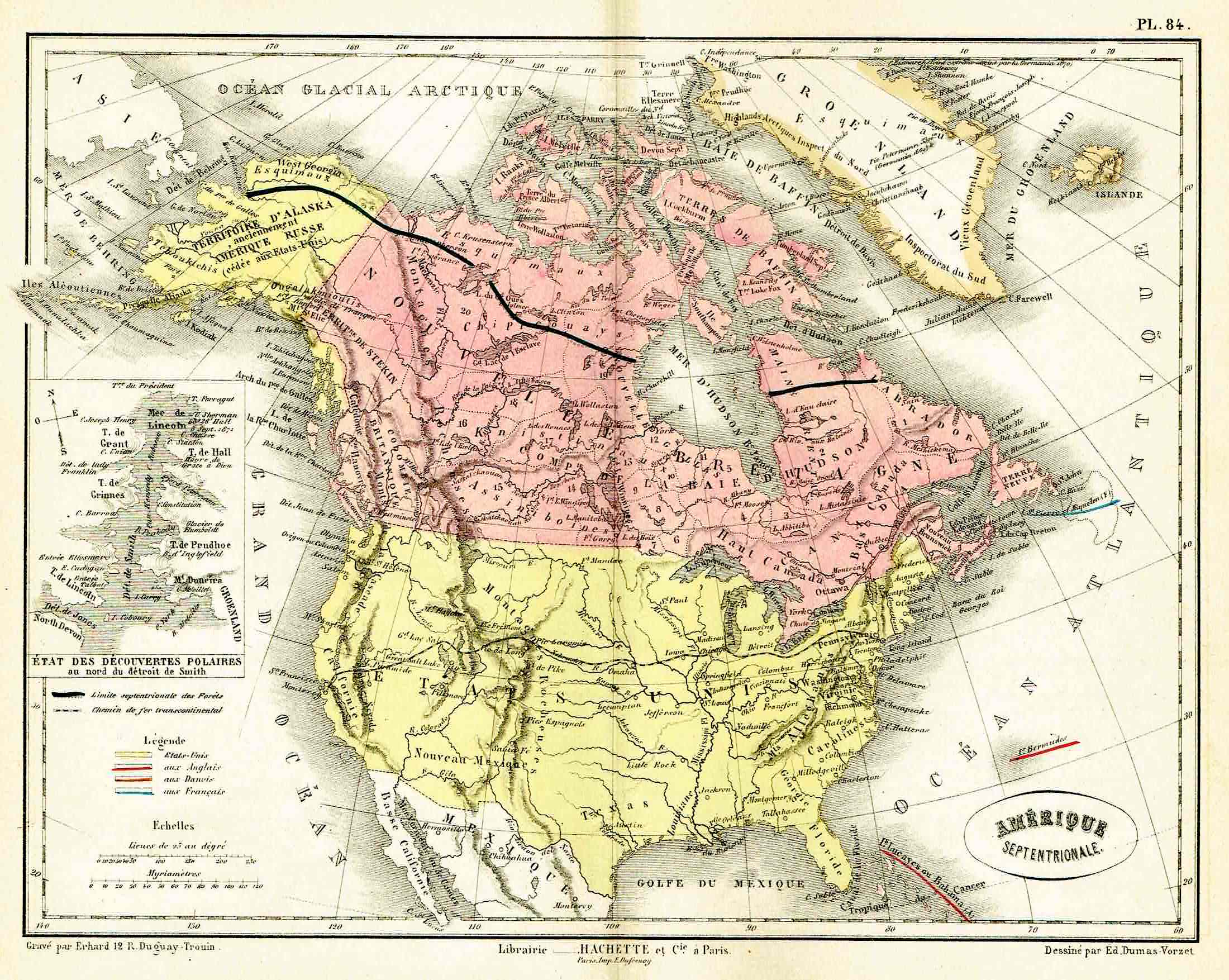
Lovely map by Eduard Dumas-Vorzet showing in nice details north America and Canada. At left inset the new polar discoveries on the Smith Sounds. From the famous Atlas Universel d’Histoire et de Geographie by Marie Nicolas Bouillet published in Paris in 1877.
- Year: 1877
- Place of publication: Paris
- Dimension: 260 x 200 mm
-
Out of stock
Detailed lovely map by Eduard Dumas-Vorzet showing Australia, New Zealand, and the island Pacific. From the famous Atlas Universel d’Histoire et de Geographie by Marie Nicolas Bouillet published in Paris in 1877.
- Year: 1877
- Place of publication: Paris
- Dimension: 260 x 200 mm


