Nice town view of Erfurt in Thringen from Bertius’s “Commentariorum rerum germanicum libri tres” published in Amsterdam at Jannsonius in 1616.
- Sorry, this product cannot be purchased.

Erdfurt
Nice town view of Erfurt in Thringen from Bertius’s “Commentariorum rerum germanicum libri tres” published in Amsterdam at Jannsonius in 1616.
- Year: 1616
- Dimension: 190 x 140 mm
- Place of publication: Amsterdam
€ 110,00
Related products
-
![]()
A beautiful colored pictorial map with inset map of Europe showing location of Nazi Germany, promoting tourism. Showing major cities, historical people and places of interest, agriculture, industry, sports, Berlin and 1936 Olympic Games. On verso map of Germany showing roads and railways, inset map of air routes, and text and tourist information. Drawn by Riemer and published in Berlin by Reichsbahnzentrale fur den Deutschen Reiseverkehr in 1941.
- Dimension: 77 x 57 cm
- Place of publication: Berlin
- Year: 1941
-
![]()
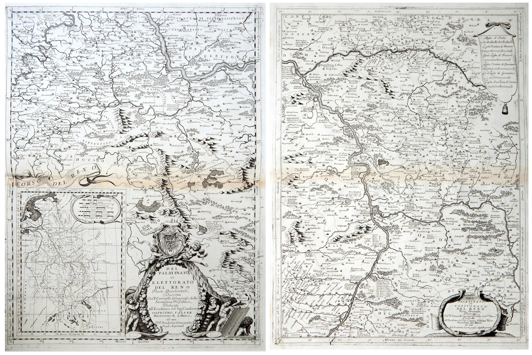
Del Palatinato et Elettorato del Reno parte Occidentale… / Del Palatinato et Elettorato del Reno parte Orientale
More Info € 600,00Very detailed and decorative map in two sheets of Rhine Valley from Coronelli’s Corso Geografico Universale published in Venice in 1690. Inset map of the entire River. Vincenzo Maria Coronelli is widely recognised as one of Italy?s most famous and greatest cartographers. He received an ecclesiastical education at the convent of the Minor Conventuals and also studied theology in Rome. However, his interests in geography and cartography were awoken early in his ecclesiastical career and never supp
- Year: 1690
- Dimension: 605 x 450 mm each
- Place of publication: Venice
-
![]() Out of stock
Out of stockA rare very detailed cartoon map of Frankfurt am Main published in Darmstadt in 1954 by Stars UY Stripes. All the historic sites, streets and famous buildings are labeled and many of them are illustrated by lovely vignettes or caricatures (see Beethoven, Goethe, Stolze, Adickes and others). The funny map drawn by Byrel W. Burgess shows also all the Frankfurt greater area with a particular attention to the American presence (schools, hospitals, posts etc.). Chicago it’s curiously drawn in top right corner.
- Dimension: 59,5 x 89 cm
- Place of publication: Darmstadt
- Year: 1954
-
![]()
Lower Saxony and Mecklenburg are the central theme of this appealing map. It covers from Lubeck and the Baltic Sea in the north to Celle, Rathenow and Spandau in the south. Adorned with strapwork title and scale cartouches. From the Mercator Hondius “Atlas Minor” published in Amsterdam in 1648 at Jannsonius. In 1607 Jodocus Hondius published a reduced size version of Mercator’s “Atlas”, itself suitably titled “Atlas Minor”. The maps were …
- Year: 1648
- Dimension: 195 x 145 mm
- Place of publication: Amsterdam