Nice town view of Halberstadt in Sachsen-Anhalt from Bertius’s “Commentariorum rerum germanicum libri tres” published in Amsterdam at Jannsonius in 1616.

Halberstatt
Nice town view of Halberstadt in Sachsen-Anhalt from Bertius’s “Commentariorum rerum germanicum libri tres” published in Amsterdam at Jannsonius in 1616.
- Year: 1616
- Dimension: 188 x 140 mm
- Place of publication: Amsterdam
€ 120,00
Related products
-
![]()
[Italian only] Eccezionale pianta prospettica della citt di Brescia incisa e pubblicata da Donato Rascicotti nella inedita e sconosciuta versione con il cartiglio nella parte destra poi eliminato nella versione definitiva a causa della lunghezza del testo descrittivo che non poteva essere contenuto. Anche il cartiglio a sinistra contenente la dedica risulta vuoto a conferma del fatto che si tratti di primissima tiratura di prova. In basso 134 rimandi …
- Year: 1648
- Dimension: 205 x 150mm
- Place of publication: Amsterdam
-
![]()
A lovely original antique miniature map centered on Bamberg showing the region of Franconia in Germany.
From the uncommon “Neu aussgeffertigter kleiner Atlas” by J. U. Muller published in Franckfurt in 1692 at Johann Philip Andrea.
The map was engraved with great care by G. Karsch e G. Bodeneher.
See G. King “Miniature antique maps” (1st edition) pag.136- Dimension: 70 x 80 mm
- Place of publication: Frankfurt
- Year: 1702
-
![]()
Important and rare map of this Germany’s area. In 1578, Gerard De Jode published his atlas entitled Speculum Orbis Terrarum.This work, likely due to the strong market presence of Ortelius’ Theatrum Orbis Terrarum, sold poorly. This map comes from the second and last edition of the Atlas by Cornelis De Jode. [cod.1240/15]
- Year: 1593
- Dimension: 305 x 506 mm
- Place of publication: Antwerp
-
![]()
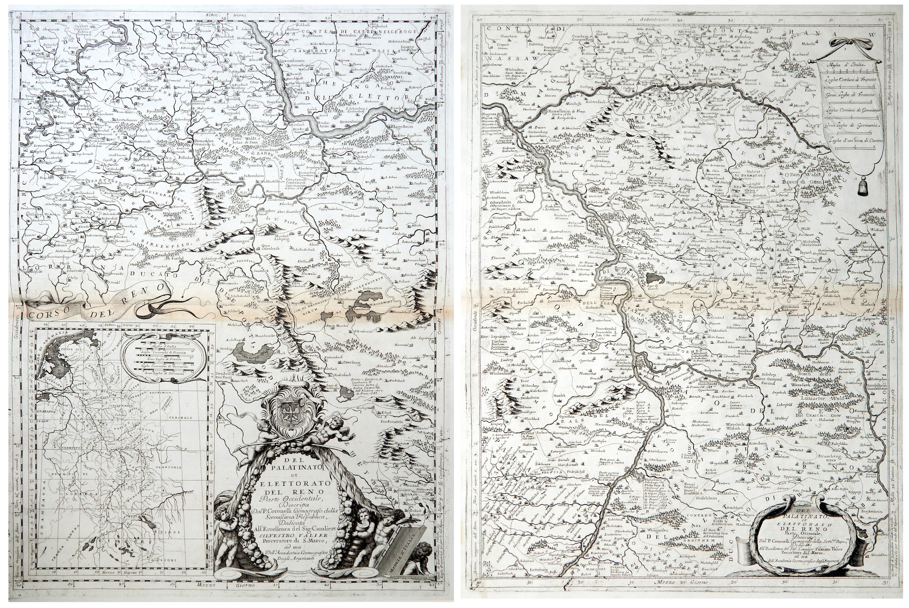
Del Palatinato et Elettorato del Reno parte Occidentale… / Del Palatinato et Elettorato del Reno parte Orientale
More Info € 600,00Very detailed and decorative map in two sheets of Rhine Valley from Coronelli’s Corso Geografico Universale published in Venice in 1690. Inset map of the entire River. Vincenzo Maria Coronelli is widely recognised as one of Italy?s most famous and greatest cartographers. He received an ecclesiastical education at the convent of the Minor Conventuals and also studied theology in Rome. However, his interests in geography and cartography were awoken early in his ecclesiastical career and never supp
- Year: 1690
- Dimension: 605 x 450 mm each
- Place of publication: Venice