America
Showing all 10 results
-
![]()
Fine map by Giovanni Antonio Magini engrave day Girolamo Porro based on Giovanni Lorenzo d’Anania’s 1582 map of the Americas and further based on the geography of Ortelius. Most notable is the characteristic bulge to the west coast of South America and the huge Southern Continent that attaches to Nova Guinea. Anian and Quivira appear on North America’s bulbous western coast. From Geografia di Claudio Tolomeo published in Padua in 1621 at Galignani.
- Year: 1621
- Dimension: 14 x 18 cm
- Place of publication: Padova
-
![]()
Rare map of Alaska (America Russa) and the contiguous parts of Canada and the US extending to the Upper Missouri River and the Fraser River. The map is one of the earliest printed maps to focus on the region which would become Alaska. From the rarest and most elegant cartographic work by Francesco Celestino Marmocchi, the Corso di Geografia Commerciale published in Genoa in 1858.
- Dimension: 27 x 34 cm
- Place of publication: Genoa
- Year: 1858
-
![]()
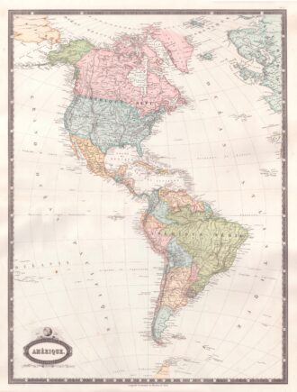
Interesting map of America with high detail and beautiful decorative colouring. The Panama Canal has not yet been built. Colombia is “Nouvelle Grenade” and Alaska is “Amerique Russe”. Much of the Amazon is labeled as “Selvas”, or tropical rainforests, and “Région Inconnue”. From Atlas Spheroidal et Universel de Geographie by M.F.A. Garnier published in Paris at Veuve Jules Renouard in 1862. This atlas is exceptional for its “spheroidal” maps of the globe, showing the various…
- Year: 1862
- Dimension: 680 x 510 mm
- Place of publication: Paris
-
![]()
Amerique ou Noveau Continent dresse sur le nouvelle relations decouvertes et observations par J.B. Nolin
More Info € 700,00A fascinating engraved map dated third years after the French revolution showing all of North and South America published in Paris by Basset, based upon work of Johann Baptist Nolin. The map includes a large inset map showing the “New Discoveries” in the Northwest part of America, most notably the depiction of prospective routes from Hudson’s Bay and Baffin’s Bay to the Pacific Ocean, based upon information provided by Joseph Nicolas De L’Isle, reporting on…
- Year: 1795
- Dimension: 470 x 680 mm
- Place of publication: Paris
-
![]()
Carte De L’Amerique Septenrionale et Meridionale … les Decourverts Les plus nouvelles et les trois Voyages de Cook, MacKenzie et Vancouver…1809
More Info € 800,00Rare map of America and the discoveries in the Pacific Ocean. Published separately by Eustace Herisson in Paris in 1809 at Bisset. The map shows a large and detailed map of the Americas, the Pacific, New Zealand and the Atlantic Ocean with engraved routes of explorations of Cook, Vancouver and Mackenzie. [cod.1233/15]
- Year: 1809
- Dimension: 760 x 520 mm
- Place of publication: Paris
-
![]()
Lovely postcard showing the meeting at Panama between the Pacific and Atlantic oceans as a kiss. Published by Curt Otto Teich in 1935 for Sucesion de Maduro a hats and parfumes shop in Panama. Curt Teich who immigrated to the United States from Lobenstein, Germany, in 1896, founded the Curt Teich Company of Chicago, which operated from 1898 to 1978 as the world’s largest printer of view and advertising postcards.
- Dimension: 90 x 140 mm
- Place of publication: Chicago
- Year: 1935
-
![]()
Large map by R. Hausermann showing the Catholic Missions in the United States, with an extensive table below listing statistics on the Church in the U.S in 1900. Published by Dufrenoy in Paris, 1900. Strong stable paper with few usual holes/creases where the folds cross. Cfr. Rumsey Collections: 4879000
- Dimension: 71 x 95 cm
- Place of publication: Paris
- Year: 1900
-
![]()
An attractive miniature map showing detailed North America divided up into Mexico, the United States, Canada, Greenland and Russia Territory (Alaska). From popular Starling’s Victorian atlas “The Royal Cabinet Atlas, And Universal Compendium Of All Places In The Known World” published by Bull and Churton in London in 1833. The map is accompanied by a page of text giving the latitude and longitude of the major towns.
- Year: 1833
- Dimension: 90 x 145 mm
- Place of publication: London
-
![]() Out of stock
Out of stockThe United States of America – A map of 48 States Easy to Read Comprehensive with over 500 Illustrations
More InfoA large illustrated map of the United States designed by Giorgio “Gio” Tavaglione published in Milan at Ricordi Arti Grafiche, 1988. The pictorial map shows 48 States each with its own Great Seal in bright contrasting colors and filled with lovely illustrations of landmarks, natural wonders, local industries, famous buildings, celebrities and animals. Richly decorated by allegorical title cartouche, compass rose, Statue of Liberty and numerous boats, ships and fish in the oceans. Below are…
- Dimension: 66 x 93 cm
- Place of publication: Milan
- Year: 1988
-
![]() Out of stock
Out of stockInteresting Japanese propaganda map centered on Pacific showing China, other East Asian countries, Russia, South East Asia, Australia, Pacific Islands and North America. It also includes many visual charts comparing the figures of army and navies of Japan, United States, Russia, and Great Britain. It also features the numbers of Japanese, living in each country or region and trading figures. This map shows the military and economic relations of Japan with other major countries and…
- Dimension: 75 x 104 cm
- Place of publication: Tokyo
- Year: 1935