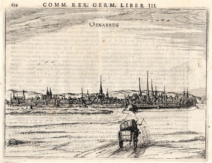
Nice town view of Osnabrck in Niedersachsen from Bertius’s “Commentariorum rerum germanicum libri tres” published in Amsterdam at Jannsonius in 1616.
Osnabrug
Nice town view of Osnabrck in Niedersachsen from Bertius’s “Commentariorum rerum germanicum libri tres” published in Amsterdam at Jannsonius in 1616.
- Author: BERTIUS Petrus
- Year: 1616
- Dimension: 195 x 145 mm
- Place of publication: Amsterdam
€ 120,00
Related products
-
Very rare map engraved by Elias Baeck from ?Der curiose und .. Nssliche Dollmetscher..? published in Augsburg in 1748. The map has decorative cartouche and a nice original colouring. Missing in many reference.
- Author: ERDMAN MACHENBAUER J.A.
- Year: 1748
- Dimension: 225 x 165 mm
- Place of publication: Augsburg
-
Out of stock
Beautifully engraved map of ancient Germany showing in hight details the northern Europe from the Adriatic to the Baltic and Netherlands.
Really interesting the latin nomenclature of the cities, town rivers and mountains.
From the 1624 final edition of Ortelius’s “Parergon in quo Veteris Geographiae aliquot tabulae… – Nomenclator Ptolemaicus” with the text by Balthasar Moretus.
Ortelius’s Parergon began as a companion to his Theatrum but eventually it became an independent work. In fact, this collection of maps of the ancient world was so significant that it became the model for all historical atlases published throughout the seventeenth century. The maps and plates in the Parergon have to be evaluated as the most outstanding engravings depicting the wide-spread interest in classical geography in the 16th century (Koeman).- Author: ORTELIUS Abraham
- Year: 1624
- Dimension: 366 x 472 mm
- Place of publication: Antewerp
-
Important and rare map of this Germany’s area. In 1578, Gerard De Jode published his atlas entitled Speculum Orbis Terrarum.This work, likely due to the strong market presence of Ortelius’ Theatrum Orbis Terrarum, sold poorly. This map comes from the second and last edition of the Atlas by Cornelis De Jode. [cod.1240/15]
- Author: DE JODE Gerard
- Year: 1593
- Dimension: 305 x 506 mm
- Place of publication: Antwerp
-
[Italian only] Eccezionale pianta prospettica della citt di Brescia incisa e pubblicata da Donato Rascicotti nella inedita e sconosciuta versione con il cartiglio nella parte destra poi eliminato nella versione definitiva a causa della lunghezza del testo descrittivo che non poteva essere contenuto. Anche il cartiglio a sinistra contenente la dedica risulta vuoto a conferma del fatto che si tratti di primissima tiratura di prova. In basso 134 rimandi …
- Author: MERCATOR Gerard - HONDIUS Henricus
- Year: 1648
- Dimension: 205 x 150mm
- Place of publication: Amsterdam


