


Uncommon regional map showing all south Italy, the ancient Kingdom of Naples, finely engraved by Pietro Allodi after a drawn by Filippo Naymiller. From Atlante di geografia universale: cronologico, storico, statistico e letterario. Milan, 1860 at Tipografia Pagnoni. Includes a second sheet of text providing really interesting geographical and statistical information on the area.
Out of stock
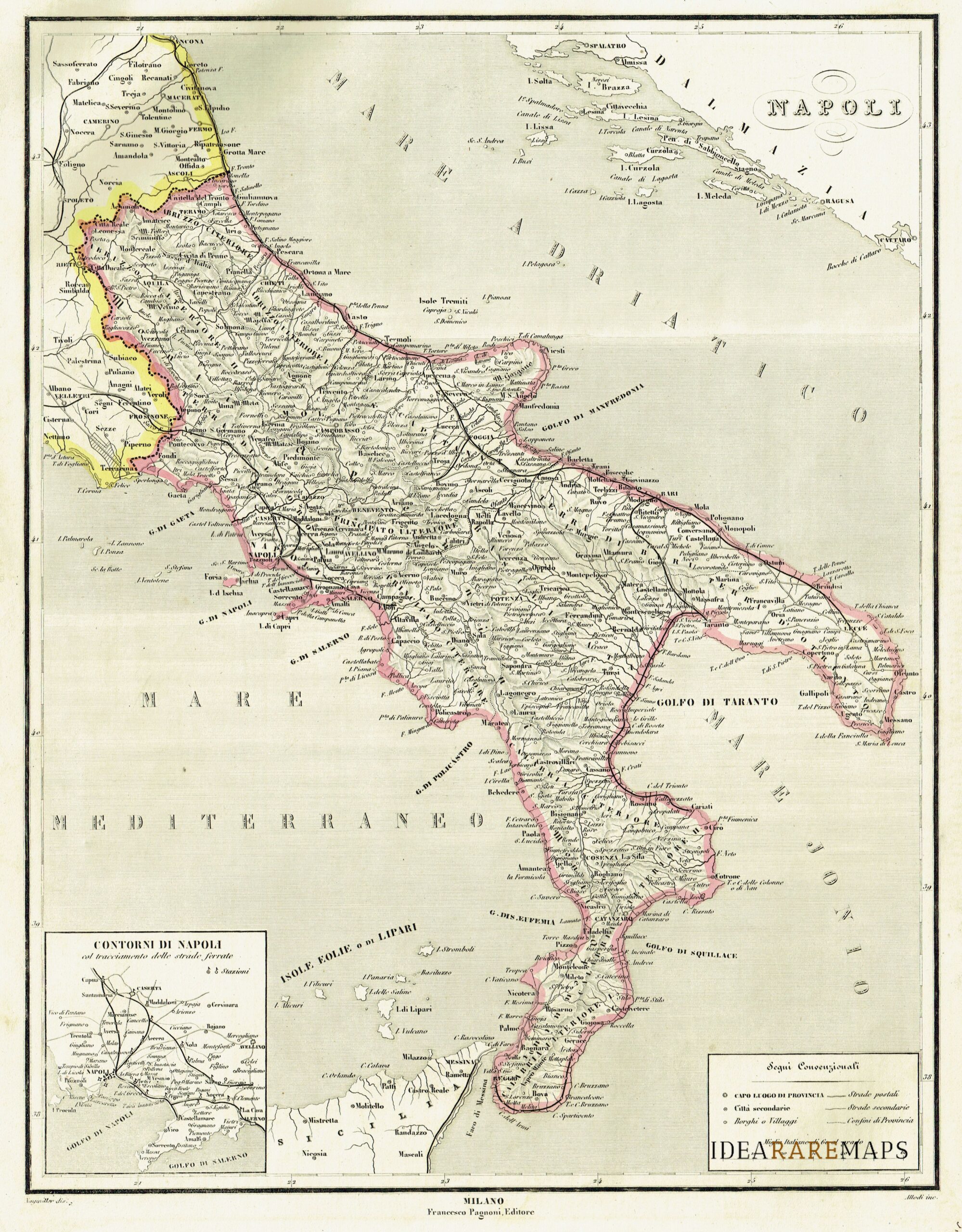
Napoli
Uncommon regional map showing all south Italy, the ancient Kingdom of Naples, finely engraved by Pietro Allodi after a drawn by Filippo Naymiller. From Atlante di geografia universale: cronologico, storico, statistico e letterario. Milan, 1860 at Tipografia Pagnoni. Includes a second sheet of text providing really interesting geographical and statistical information on the area.
- Year: 1860
- Place of publication: Milan
- Dimension: 43 x 33 cm
Related products
-
![]()
The map of Kingdom of Naples engraved by G. Bodenher from the very rare Der curiose und .. Nussliche Dollmetscher.. published in Augsburg in 1748 by Machenbauer. The map has decorative cartouche and a nice original coloring.
- Year: 1748
- Dimension: 285 x 155 mm
- Place of publication: Augsburg
-
![]() Out of stock
Out of stockNice birdeye vie of the Gulf of Neaples from Zeiller’s “Itinerarium Italia Nova Antiqua” published by Merian in Franckfurt in 1640. Mattheus Merian was a notable Swiss engraver, born in Basle in 1593, who subsequently studied in Zurich and then moved to Frankfurt where he met Theodore de Bry, whose daughter he married in 1617. […] [cod.451/15]
- Year: 1688
- Dimension: 302 x 204 mm
- Place of publication: Frankfurt
-
![]()
Nice and detailed map from “Parallela geographica Italiae veteris et novae”, a very rare work by Philip Briet published in Paris in 1649 at Sebastian Cramoisy. [cod.462/15]
- Year: 1649
- Dimension: 145 x 190 mm
- Place of publication: Paris
-
![]()
Nice and detailed map of Campania with Neaples and Sorrento and Capitanata in Puglia from “Parallela geographica Italiae veteris et novae”, a rare work by Philip Briet published in Paris in 1649 at Sebastian Cramoisy. [cod.458/15]
- Year: 1653
- Dimension: 145 x 190 mm
- Place of publication: Paris


