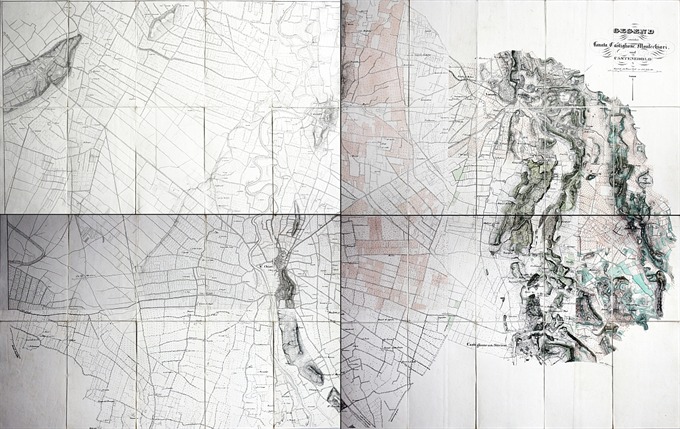
A rare large map of Lonato, Castiglione delle Stiviere, Montichiari and Castenedolo dissected and backed on linen. Published in Wien in 1820 ca.
Gegend zwischen Lonato, Castiglione, Montichiari und Castenedolo
A rare large map of Lonato, Castiglione delle Stiviere, Montichiari and Castenedolo dissected and backed on linen. Published in Wien in 1820 ca.
- Author: Ufficio Topografico Militare Austriaco
- Year: 1820
- Dimension: 1450 x 900 mm
- Place of publication: Vienna
€ 1.400,00
Related products
-
Out of stock
Questa rarissima carta geografica del territorio Bresciano è tratta dall’opera Italia geographice historiceque tabulis aeneis 37 delineata di Corrado Leone e pubblicata a Colonia nel 1598 con i tipi di Bertrami Buchholtz. L’interessante mappa appartiene alla cosiddetta Scuola Cartografica di Colonia che per circa mezzo secolo fu il centro più importante nella produzione geografica dovuta principalmente ai cartografi ed artisti fiamminghi ed olandesi che fuggivano dalle persecuzioni religiose. Gli esponenti maggiori furono Mattheus Quad, Giovanni Botero, Johannes Metellus e il fondatore Franz Hogenberg. Gli atlanti e le carte prodotte a Colonia in quel tempo venivano spesso pubblicate in forma anonima o con l’utilizzo di pseudonimi e quindi la loro genesi così come gli esatti dati editoriali risultano, a volte, piuttosto vaghi. Per quanto riguarda l’aspetto tecnico cartografico possiamo facilmente identificare il modello di riferimento nella medesima mappa del territorio Bresciano che Ortelius aveva pubblicato ad Anversa nel 1590 all’interno del celebre Theatrum Orbis Terrarum. Troviamo il classico orientamento a sinistra, lo stesso gusto rinascimentale del cartiglio con il titolo e tutti gli aspetti cartografici derivanti a loro volta dalla fondamentale grande mappa del Sorte. Manca il margine graduato con l’indicazione di latitudine e longitudine e i punti cardinali oriens, occidens e meridies sono inseriti entro il territorio. In basso è presente semplice scala grafica di 15 miglia Italiane.
- Author: METELLUS Johannes
- Year: 1598
- Dimension: 287 x 198 mm
- Place of publication: Colonia
-
Out of stock
Importante e rara carta geografica che mostra la porzione di territorio nel nord Italia scenario delle battaglie combattute durante la guerra di successione spagnola da Eugenio di Savoia. La mappa è di grande interesse anche perchè documenta una produzione cartografica a Bologna ed è inoltre una rappresentazione originale non basata su prototipi o carte precedenti ma ottenuta da rilevamenti diretti sul campo: l’autore infatti inquadra nel suo disegno solo i territori effettivamente percorsi degli eserciti…
- Author: DURELLO Simone
- Year: 1702
- Dimension: 461 x 690 mm
- Place of publication: Bologna
-
Plan and fortification of the town from “Force D’Europe…” by G. Bodenehr published in Augsburg in 1725. Perfect condition. [cod.109/15]
- Author: BODENHER Gabriel
- Year: 1725
- Dimension: 180 x 295 mm
- Place of publication: Augsburg
-
[Brescia] Veduta di Brescia da Porta San Nazaro – Terra Antiqua, potens armis atque ubere glebe dedicata a Luigi Arici
More InfoLa più importante, ambita e rara veduta generale della città di Brescia
- Author: Domenico Carboni
- Year: 1764
- Dimension: 1360 x 605 mm
- Place of publication: Brescia


