Rare copper engraving showing 20 German town.
Out of stock

D’Voornaamste Fortresse aen de Rivier den Rhyn
Rare copper engraving showing 20 German town.
- Year: 1680
- Dimension: 445 x 570 mm
- Place of publication: Amsterdam
Related products
-
![]()
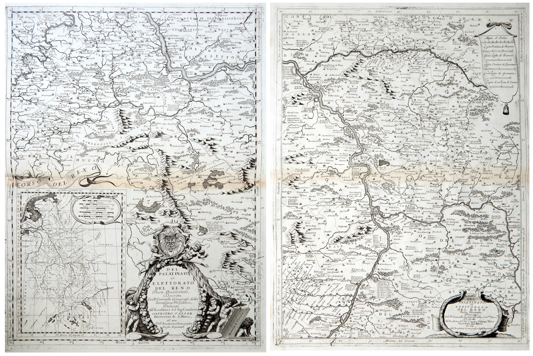
Del Palatinato et Elettorato del Reno parte Occidentale… / Del Palatinato et Elettorato del Reno parte Orientale
More Info € 600,00Very detailed and decorative map in two sheets of Rhine Valley from Coronelli’s Corso Geografico Universale published in Venice in 1690. Inset map of the entire River. Vincenzo Maria Coronelli is widely recognised as one of Italy?s most famous and greatest cartographers. He received an ecclesiastical education at the convent of the Minor Conventuals and also studied theology in Rome. However, his interests in geography and cartography were awoken early in his ecclesiastical career and never supp
- Year: 1690
- Dimension: 605 x 450 mm each
- Place of publication: Venice
-
![]()
Neue und vollständige Postkarte durch ganz Deutschland – Nouvelle Carte geographique des Postes D’Allemagne
More Info € 400,00Very interesting engraved map compiled by Johann Jakob von Bors and Franz J. Heger, dissected and mounted on linen, showing the mail routes with distances measured in hours on horseback and hours with the stagecoach. The large map extending west to east from Paris to Cracau and north to south from Königsberg to upper Italy with the nice depiction of the important road from Venice to Turin via Milan, Bergamo and Brescia. Very decorative allegorical cartouches and lower left portions of map, key in French and German. Original colors in outline. In nice condition to be a separate publishing used in traveling. Published at Homann Heir in 1764 (dated). First Edition.
- Dimension: 75 x 95 cm
- Place of publication: Nuremberg
- Year: 1786
-
![]()
Lovely small map of Upper Sachsen and Schlesien centered roughly on Meissen with place names, rivers and forests. From the Mercator Hondius “Atlas Minor” published in Amsterdam in 1648 at Jannsonius. In 1607 Jodocus Hondius published a reduced size version of Mercator’s “Atlas”, itself suitably titled “Atlas Minor”. The maps were copied from those of the great cartographer Mercator of around 1580-90 or were reductions of Hondius’ own maps of 1606.
- Year: 1648
- Dimension: 195 x 145 mm
- Place of publication: Amsterdam
-
![]()
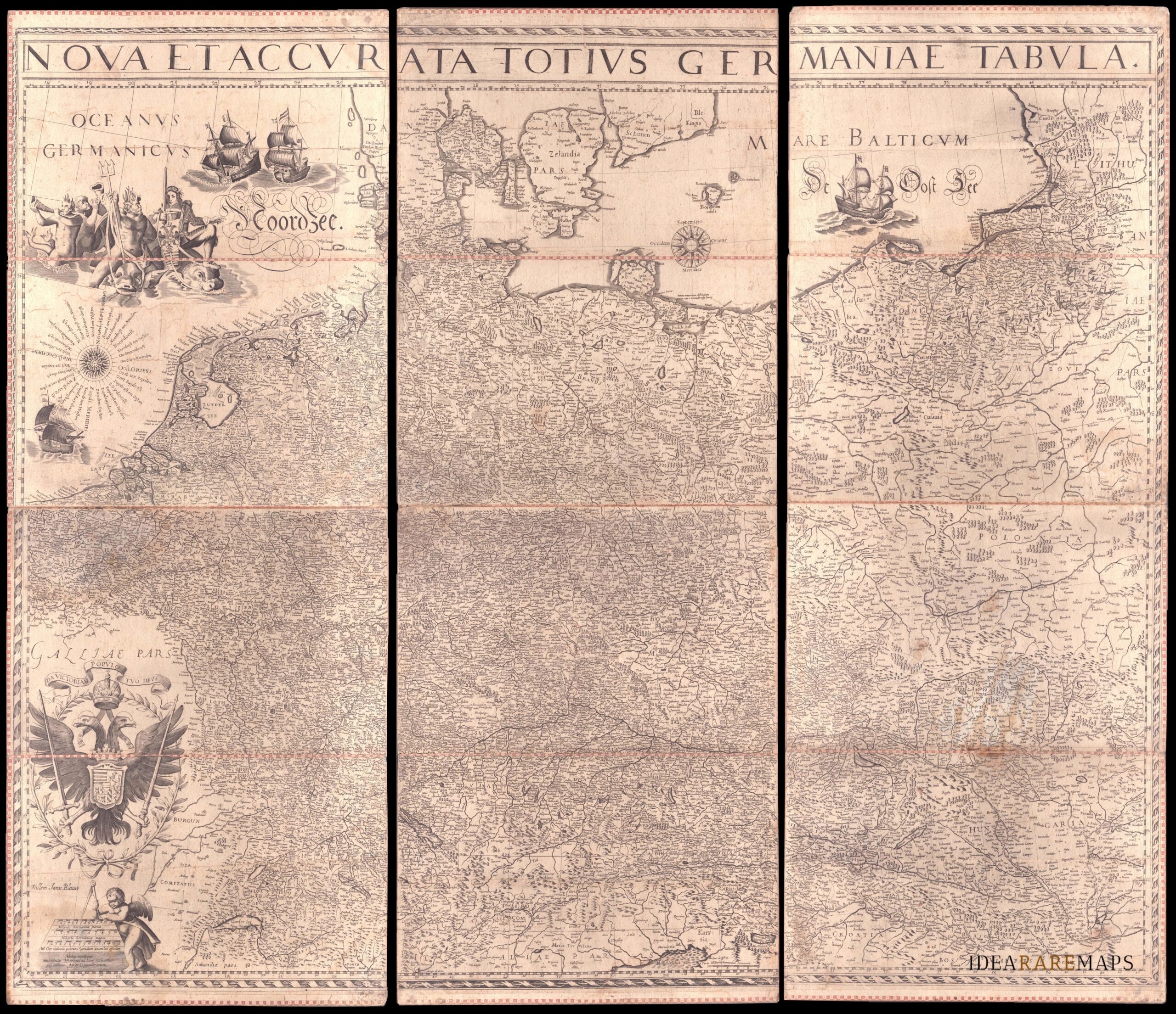
An exceptional wall map of the German Empire showing the Netherlands, Germany, Switzerland, Austria, Bohemia, Moravia, Poland and the Baltic Countries. Only three other copies are known to Schilder. Contemporary mounted on cardboard.
- Dimension: 108 x 125 cm
- Place of publication: Amsterdam
- Year: 1639