A lovely original antique miniature map showing the Electorate of Mainz in Rhineland-Palatinate in Germany.
From the uncommon Neu aussgeffertigter kleiner Atlas by J. U. Muller published in Frankfurt in 1692 at Johann Philip Andrea.
The map was engraved with great care by G. Karsch e G. Bodeneher.
See G. King Miniature Antique Maps (1st edition) pag.136
Out of stock

Archiepiscopatus et Electoratus Mainz
A lovely original antique miniature map showing the Electorate of Mainz in Rhineland-Palatinate in Germany.
From the uncommon Neu aussgeffertigter kleiner Atlas by J. U. Muller published in Frankfurt in 1692 at Johann Philip Andrea.
The map was engraved with great care by G. Karsch e G. Bodeneher.
See G. King Miniature Antique Maps (1st edition) pag.136
- Dimension: 70 x 80 mm
- Place of publication: Frankfurt
- Year: 1702
Related products
-
![]()
Lovely small map of Upper Sachsen and Schlesien centered roughly on Meissen with place names, rivers and forests. From the Mercator Hondius “Atlas Minor” published in Amsterdam in 1648 at Jannsonius. In 1607 Jodocus Hondius published a reduced size version of Mercator’s “Atlas”, itself suitably titled “Atlas Minor”. The maps were copied from those of the great cartographer Mercator of around 1580-90 or were reductions of Hondius’ own maps of 1606.
- Year: 1648
- Dimension: 195 x 145 mm
- Place of publication: Amsterdam
-
![]()
A most decorative map of Prussia. It replaced the older map (v.d.Broecke, map 156) in the editions from 1595 on. It is based on the large woodcut map of Prussia by Caspar Henneberg of 1576. Van den Broecke: 157
- Year: 1603
- Dimension: 367 x 468 mm
- Place of publication: Antwerp
-
![]()
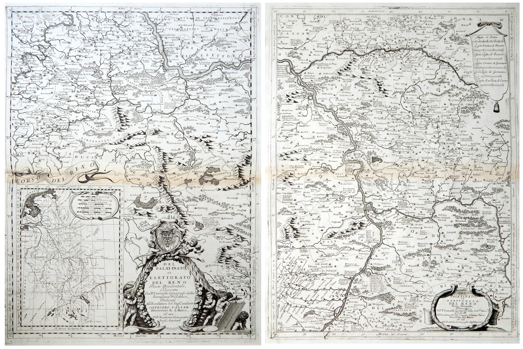
Del Palatinato et Elettorato del Reno parte Occidentale… / Del Palatinato et Elettorato del Reno parte Orientale
More Info € 600,00Very detailed and decorative map in two sheets of Rhine Valley from Coronelli’s Corso Geografico Universale published in Venice in 1690. Inset map of the entire River. Vincenzo Maria Coronelli is widely recognised as one of Italy?s most famous and greatest cartographers. He received an ecclesiastical education at the convent of the Minor Conventuals and also studied theology in Rome. However, his interests in geography and cartography were awoken early in his ecclesiastical career and never supp
- Year: 1690
- Dimension: 605 x 450 mm each
- Place of publication: Venice
-
![Germany Vintage Pictorial map]() Out of stock
Out of stockColor pictorial map, with decorative border and title cartouche over compass rose. Shows vignettes of landmarks and buildings, vessels and steam boats, rivers and mountains. Includes inset 8 vignettes showing allegories of science, transport, aeronautics, technics, art, architecture, sport and music. Published by Reichsbahnzentrale fur den Deutschen Reisenverkher in Berlin at Erasmusdruck, 1930.
- Dimension: 58 x 42 cm
- Place of publication: Berlin
- Year: 1930