Color pictorial map of North and Central America, with decorative title cartouche and borders, depict countries, regions, major cities, industries, agriculture, Indian settlements and wildlife. Includes decorative compass rose oriented with the north to the upper margin. Relief shown pictorially. Published by Ode Paris in 1951 from a drawn by Jaques Liozu.
- Sorry, this product cannot be purchased.
Out of stock

Amerique du Nord et Centrale
Color pictorial map of North and Central America, with decorative title cartouche and borders, depict countries, regions, major cities, industries, agriculture, Indian settlements and wildlife. Includes decorative compass rose oriented with the north to the upper margin. Relief shown pictorially. Published by Ode Paris in 1951 from a drawn by Jaques Liozu.
- Dimension: 410 x 560 mm
- Place of publication: Paris
- Year: 1951
Related products
-
![]()
Lovely pictorial map of the United States featuring information about the varied backgrounds of the citizens and the industries in different parts of the country. The very decorative promotional map issued for the Brussels Universal Exhibition of 1958 shown on America as a multi-national, multi-cultural nation. The map is covered with pictorial images of historical sites and Americans working and playing. Labels on each state show the principal national origins of the residents, for example, Danish, Dutch and German in South Dakota. Across the top are eight figures in stereotypical native clothing (kilt, sombrero, wooden shoes). Puerto Rico, Hawaii, and Alaska are shown as territories. At Bottom left the author’s signature. This map was issued as a folded map and it retains its folds.
- Dimension: 49 x 69 cm
- Year: 1958
-
![]() Out of stock
Out of stockPictorial map of the United States featuring portraits of iconic American Jazz musicians like: Paul Desmond, Dave Brubeck, Jimmy Giuffre, Lambert, Hendricks & Ross, Gerry Mulligan, Bessie Smith, Coleman Hawkins, Stan Kenton, Lester Young, Woody Herman, John Coltrane, Bix Beiderbecke, Louis Armstrong, Count Basie, Charlie Parker, Art Tatum, Bennv Goodman, Dizzy Gillespie, Oscar Peterson, Billie Holidav, Lennie Tristano, Stan Getz, Ornette Coleman, Jerry Roll Morton, Eric Dolphy, Duke Ellington, Ella Fitzgerald, Charles Mingus, Gil Evans.…
- Dimension: 100 x 69 cm
- Place of publication: Ferrara
- Year: 1984
-
![]()
Lovely engraved map based on the cartography by C. Franz Radefeld (1788-1874) showing the Arkansas, Mississipi, Louisiana, Alabama and Florida Panhandle. Inset of New Oreleans suurndings. From the “Meyer’s Neuester Zeitungs Atlas” published by Bibliographischen Instituts in Hildburghausen in 1849-52. The innovation of this work is that almost all maps had small inserts showing richly detailed maps of major cities and their surrunding areas: so not only could travellers carry the atlas with them
- Year: 1849
- Dimension: 270 x 200 mm
- Place of publication: Hildburghausen
-
![]()
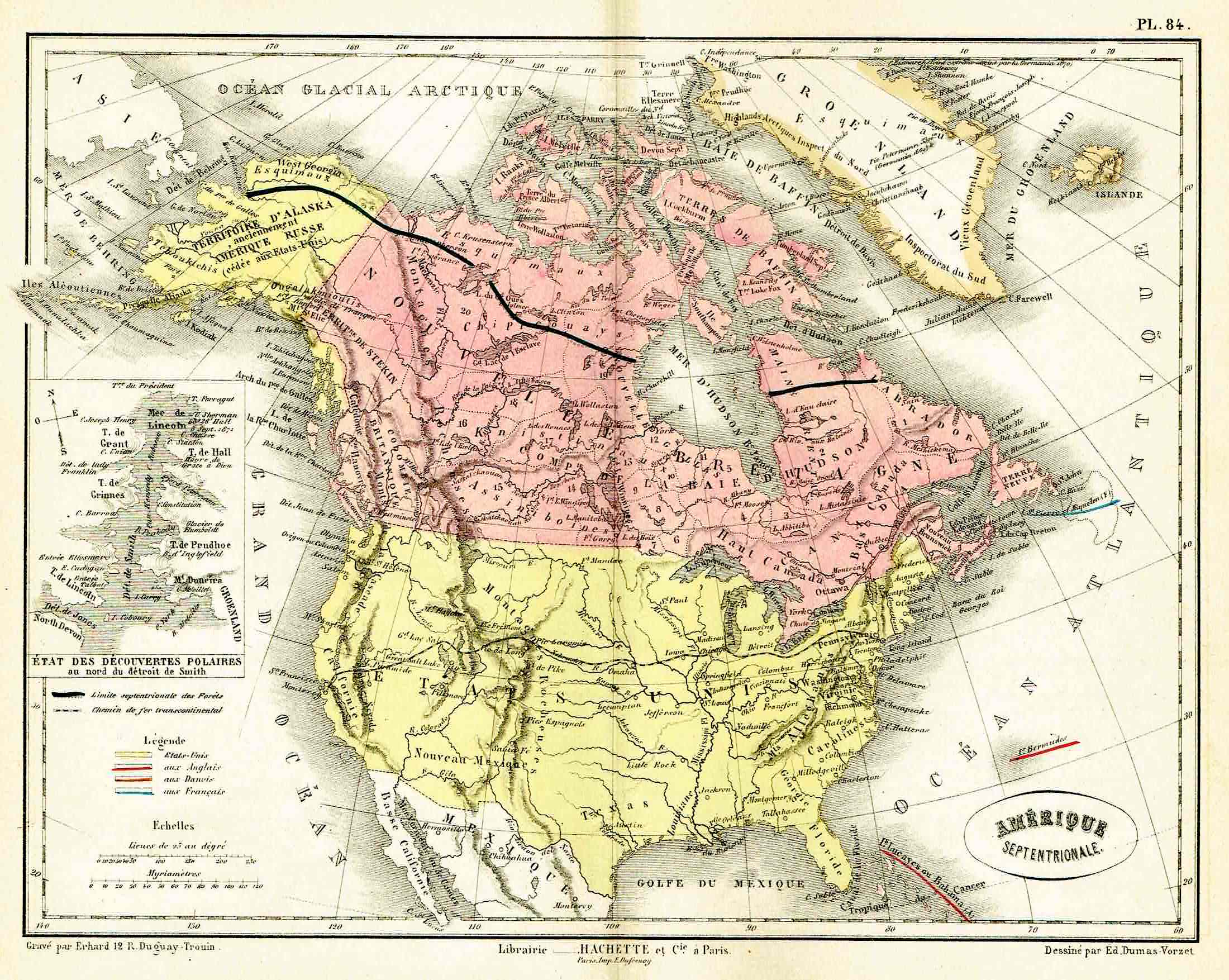
Lovely map by Eduard Dumas-Vorzet showing in nice details north America and Canada. At left inset the new polar discoveries on the Smith Sounds. From the famous Atlas Universel d’Histoire et de Geographie by Marie Nicolas Bouillet published in Paris in 1877.
- Year: 1877
- Place of publication: Paris
- Dimension: 260 x 200 mm