Jacques Liozu
Showing all 8 results
-
![pictorial map world]() Out of stock
A refined and exuberant pictorial map of the world, conceived by the French illustrator Jacques Liozu in 1951 for the renowned Parisian art publisher Odé. The work explores the genre of figurative cartography with a distinctly decorative style that draws on both the aesthetics of the late Art Deco period and the great tradition of 17th-century Baroque cartography, reinterpreting it with the freshness and vibrancy typical of mid-20th-century editorial illustration. Each continent is brought to…
- Dimension: 33 x 50 cm
- Place of publication: Paris
- Year: 1951
-
![]()
Color pictorial map of Auvergne covered with vignettes drawings of people and products of the province with explanation, representing region’s historical figures and events, resources, sights, churches, important buildings, people, activities, crops, etc. Includes decorative title cartouche and compass rose. Relief shown pictorially. Published by Ode Paris in 1951 from a drawn by Jaques Liozu.
- Dimension: 490 x 340 mm
- Place of publication: Paris
- Year: 1951
-
![]()
Color pictorial map of Central and Eastern Europe from Greece to Poland, Baltic and Russia, with decorative title cartouche and borders, depict countries, regions, major cities, industries, agriculture and wildlife. Includes decorative compass rose oriented with the north to upper left margin. Relief shown pictorially. Published by Ode Paris in 1951 from a drawn by Jaques Liozu.
- Dimension: 410 x 560 mm
- Place of publication: Paris
- Year: 1951
-
![]()
Color pictorial map of Franche Comte now Bourgogne covered with vignettes drawings of people and products of the province with explanation, representing region’s historical figures and events, resources, sights, churches, important buildings, people, activities, crops, etc. Includes decorative title cartouche and compass rose. Relief shown pictorially. Published by Ode Paris in 1951 from a drawn by Jaques Liozu.
- Dimension: 490 x 320 mm
- Place of publication: Paris
- Year: 1951
-
![]()
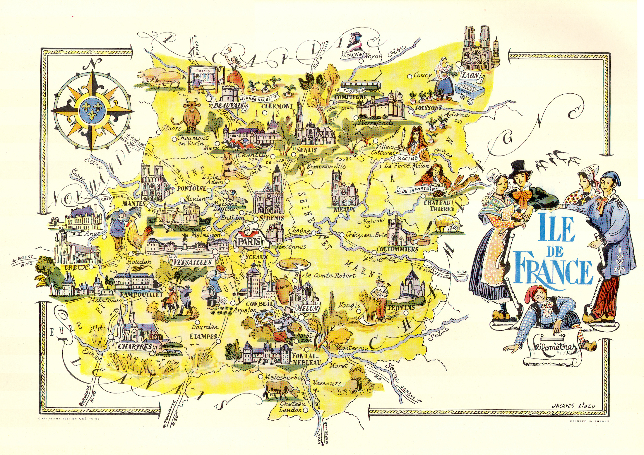
Color pictorial map of Ile de France and Paris covered with vignettes drawings of people and products of the province with explanation, representing region’s historical figures and events, resources, sights, churches, important buildings, people, activities, crops, etc. Includes decorative title cartouche and compass rose. Relief shown pictorially. Published by Ode Paris in 1951 from a drawn by Jaques Liozu.
- Dimension: 490 x 320 mm
- Place of publication: Paris
- Year: 1951
-
![]()
Color pictorial map of Limousin and Marche covered with vignettes drawings of people and products of the province with explanation, representing region’s historical figures and events, resources, sights, churches, important buildings, people, activities, crops, etc. Includes decorative title cartouche and compass rose. Relief shown pictorially. Published by Ode Paris in 1951 from a drawn by Jaques Liozu.
- Dimension: 490 x 340 mm
- Place of publication: Paris
- Year: 1951
-
![]()
Color pictorial map of Maine-et-Loire covered with vignettes drawings of people and products of the province with explanation, representing region’s historical figures and events, resources, sights, churches, important buildings, people, activities, crops, etc. Includes decorative title cartouche and compass rose. Relief shown pictorially. Published by Ode Paris in 1951 from a drawn by Jaques Liozu.
- Dimension: 490 x 320 mm
- Place of publication: Paris
- Year: 1951
-
![]()
Color pictorial map of department of Nord, France (which is part of the current Nord-Pas-de-Calais region) covered with vignettes drawings of people and products of the province with explanation, representing region’s historical figures and events, resources, sights, churches, important buildings, people, activities, crops, etc. Includes decorative title cartouche and compass rose. Relief shown pictorially. Published by Ode Paris in 1951 from a drawn by Jaques Liozu.
- Dimension: 490 x 320 mm
- Place of publication: Paris
- Year: 1951