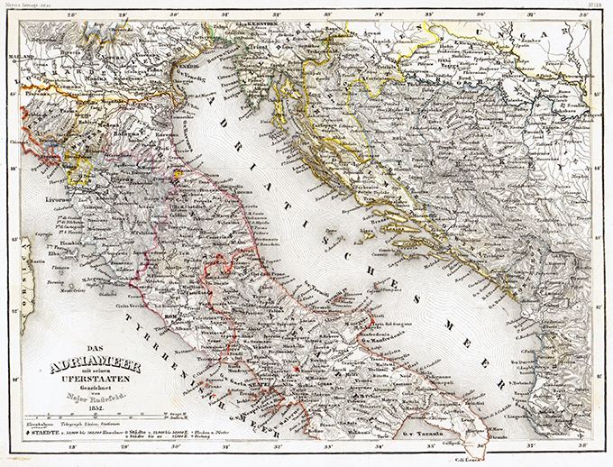
Deliziosa carta geografica basata sulla cartografia di C. Franz Radefeld (1788-1874) raffigurante il Mare Adriatico con, in bel dettaglio le coste della Croazia e dell’Italia. Tratta dall’opera Meyer’s Neuester Zeitungs Atlas pubblicata dal Bibliographischen Instituts a Hildburghausen tra il 1849 e il 1852. “The finest “quarto” German atlas of the mid 19th century”. Jurgen Espenhorst – Petermann’s Planet – Guide to the great handatlases, 3.1.1
Das Adriameer
Deliziosa carta geografica basata sulla cartografia di C. Franz Radefeld (1788-1874) raffigurante il Mare Adriatico con, in bel dettaglio le coste della Croazia e dell’Italia. Tratta dall’opera Meyer’s Neuester Zeitungs Atlas pubblicata dal Bibliographischen Instituts a Hildburghausen tra il 1849 e il 1852. “The finest “quarto” German atlas of the mid 19th century”. Jurgen Espenhorst – Petermann’s Planet – Guide to the great handatlases, 3.1.1
- Autore: MEYER Joseph
- Anno: 1849
- Dimensione: 250 x 185 mm
- Luogo di stampa: Hildburghausen


